1 - 3 of 3 records
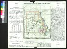
Geographical, Statistical, and Historical Map of Missouri

Description: Appeared in Carey & Lea's American Atlas (first published in 1822). Missouri was not included in the Atlas until 1823, one year after it was given statehood.,On verso: Handwritten note
Member of: Venable Maps
Resource Type: cartographic
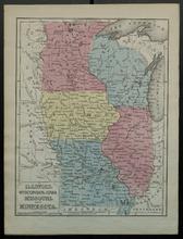
Illinois, Wisconsin, Iowa, Missouri, and Minnesota

Description: Appeared in Mitchell's New Intermediate Geography (published in various editions between 1869 and 1901). Different editions were produced for different states.,On verso: Text: Questions on the Map of Michigan, Ohio, Indiana, and Kentucky
Member of: Venable Maps
Resource Type: cartographic
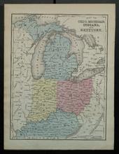
Map of Ohio, Michigan, Indiana, and Kentucky

Description: Appeared in Mitchell's New Intermediate Geography (published in various editions between 1869 and 1901). Different editions were produced for different states.,On verso: Text: Questions on the Map of Louisiana, Texas, and Arkansas
Member of: Venable Maps
Resource Type: cartographic