1 - 15 of 15 records
Africa (1860)
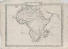
Description: Steel engraved map of the whole African Continent. The map gives several geographic details on place names, rivers, mountains, and bays. The map is adorned with decorative borders. Countries shown: Algeria, Angola, Benin, Botswana, Burkina Faso, Burundi, Cameroon, Cape Verde, Central African Republic, Chad, Comoros, Democratic Republic of Congo, Djibouti, Egypt, Equatorial Guinea, Eritrea, Ethiopia, Gabon, Gambia, Ghana, Guinea, Guinea-Bissau, Ivory Coast, Kenya, Lesotho, Liberia, Libya, Madagascar, Malawi, Mali, Mauritania, Mauritius, Morocco, Mozambique, Namibia, Niger, Nigeria, Republic of Congo, Rwanda, São Tomé and Príncipe, Senegal, Seychelles, Sierra Leone, Somalia, South Africa, South Sudan, Sudan, Swaziland, Tanzania, Togo, Tunisia, Uganda, Zambia, and Zimbabwe. Cities of many of these countries as well as Bays and Rivers in these Countries are present including Aden and Mocha Yemen, Brava (Barawa), Torra, Jillip (Jilib), Magadoxo (Mogadishu), Barboni, Auxa, Hurrur, Zeyla (Zeila), and Somauli, Somalia, Angot, Antalo (Hintalo), Genater, Axum, Gondar, Sokota (Soqota), Tegulet, Bure, Moumi, Bosham, and Ankober, Ethiopia, Massowa (Massawa), Eritrea, Sennar, Teawa (Al Qadarif), Takala, Halfay, Shendy, Atbara (Atbarah), Melcheir, Berber, El Obeid (Al-Ubayyid), Suakin, Amour, Cobbe, Meroe (Merowe), Old Dongola (Dunqulah al-Ajuz), New Dongola (Dongola), Hannek, Leghea, Kouke, Kolbe, Sebma,and Khartoum, Sudan, Mecca and Medina, Saudi Arabia, Ipsambol (Abu Simbel), Assouan (Aswan), Edfou (Edfu), Thebes, Wah el Khargeh, El danan, Siout (Asyut), Minyeh, Abu Firgeh, Snez (Suez), Cairo, Cohizeh, Wah el Daleel, Farafreh (Farafra), Al Kasar, Sywah, Dresieh, Tifah, Damietta, Rosetta, Alexandria, Port Mahadda, and Derr (el-derr), Egypt, Akaba (Aqaba), Jordan, Jerusalem, Israel, Tarffanah, Jedid, Aujilah, Febabo, Zellah (Zella), Bureigah, Taukruo, Tolmeita (Tolmeitha), Boussaida, Ghirzah, Misratah (Misrata), Beniolid, Lebdah, Tripoli, Sokna, Sebba, Omlaraneb, Mafen, Gertrone, Tejert, Legkrir, El Baab, Monrzouk, Ghraat, Winega, Tadera, Labbiyed Gadamis (Ghadames),Grennat, Marajeh, Hanieh, and Dernah (Derna), Libya, Tierel, Mobadia, Sousah, and Tunis, Tunisia, and Bonah, Boujayah, Deltyz, Setif (Sétif), Constantina (Constantina), Tuggurt (Touggourt), Engousah, Algiers, Tenez (Ténès), Hamisa, Oran, Arzaw, Al Aghouath, Gardeia, Grara, Farsile, Ain Salah (In Salah), Agabli, Temadran, Armaghi, Al Walen, Tlemezen (Tlemcen), Fighig, and Al Galah, Algeria, Madroma, Tétouan, Tangier, Mequinez (Mekne), Fez (Fes), Segdmesa (Sijilmasa), Tabelhat, Tafilet (Tafilalt), Gourtand, Mansoriah, Azamor (Azemmour), Saffi (Safi), Al Kala, Magador, Agadir, Talent, Al Harib, Tatta, Nun, Saleco, Alekah, Al Guedea, and Marabooti, Morocco, Melilla, and Ceuta, Spain, Teneriffe (Tenerife), Canary Islands, St. Louis (Saint-Louis), Bakel, Hyenne, Sedo, Joal (Joal Fadiout), and Casamanza, Senegal, Kahede (Kaedi), Mauritania, Bangassi, Mali, Bathurst (Banjul), Gambia, Timbo, Guinea, Falaba, Sierra Leone, Monrovia, Tradetown, Settra Kroo, Sesters, Harper, and Bassa, Liberia, Tabou (Dabou), Bardy, King George Town, Lahou (Grand Lahou), Ivoery Town, Assineco, Ivory Coast, Apoflonia, Cape Three Points, Cape Coast Castle, Coomassie (Kumasi), Winabah (Winneba), Accra, and Adda (Ada Foah), Ghana, Badagry, Jenna, Engua, Koussou, Brass, Ibou, Beran, Iddah (Idah), Funda, Jacoba, Yola, Yakoba, Koji, Dikoa, Kuka (Kukawa), Boari, Kano, Bebeji, Zaria, Womba, Tabra, Egga, Eyeo, Boussa (New Bussa), Yaouri (Bin Yauri), and Dukes Town (Akwa Akpa or Calabar), Nigeria, Abomey, Benin, Boos, Niger, Williamstown, Cameroon, Adjumba, Gabon, Kabenda (Cabinda), Caconga (Cacongo), Sonho (Soyo), Batta, S. Salvador (M'banza-Kongo), Oando, Oaculo, Mani, Ambria, Casaba, Cassange, Tanza, Cambambe, Lutato, Old Benguela (Porto Amboim), Tamba, Bomba, Balhinda, Quisongi, Novo Redondo (Sumbe), Cabuto, Philip de Benguela (Benguela), Angaruca, Bihe, Caconda, Quilamata, Dumbo (Mandume), Quimbianba, and S. Paul de Loando (Luanda), Angola, Ondonga, Oyando, Orajo, Okavara, Burmen, Niaxs, Wesley Vale, Betni, Bethany (Bethanie), Africaners Kraal, and Rehoboth, Namibia, Kolobeng (Kolobeng Mission), Botswana, Pella, Lady Fn, Camel Mouth, Tulbagh, Stellenbosch, Clanwilliam, Cape Town, George, Uitenhage, Bathurst, Beaufort (Beaufort West), Cradock, Grahams Town, (Grahamstown), Fredericksburg, London (East London), Butterworth, Palmerston, Matuana Kraal, Phillipolis (Philippolis), Moriah, Griania, Kruman (Kuruman), Lattakoo (Dithakong), Moshow, Port Natal & D'Urban (Durban), Pietermaritzburg, Lakalabaldi, Potchefstroem (Potchefstroom), and Warm Bed, South Africa, Inhambane, Buok, Sofala (Nova Sofala), Luabo, Quillimane (Quelimane), Zumbo, Tete, Mesuril (Mossuril), Querimba (Quirimba), and Sena (Vila de Sena), Mozambique, Masapa (Massapa), Zumbo, Chicova, and Luanza (Luanze, Ruhanje), Zimbabwe, Sekeletu, Sesheke, and Sekhos, Zambia, Amboule, Tullear (Toliara), Fort Dauphin (Tôlanaro), Manamvatoo, Mananzari (Mananjary), Oiube, Voubai, Menabe, Mouron dava (Morondava), Enboudiaro, Andevorande (Andevoranto), Befaxona, Tananarivo (Antananarivo), Inaoja, Tamatave (Toamasina), Ifontsy, Vouipafie, Bembatooka, Tanzou, Narinda, Moringa, Angonta or Ngoncy, Ifonty, Passandava, and Mananbatou (Manambato), Madagascar, Saint-Denis, Réunion, Port Louis, Mauritius, and Quiloa (Kilwa Kisiwani), Tanzania, and the unknown locations of Argian, Hoden, Tisbeet, Shingaria, Kemmoo, Bambouk, Koena, Medina, Pisania, S. Domingo, Kakundy, Simera, Couseca, Aladah, Yandi, Bombom, Farfar, Korongo, Mombum, Doka, Salang, Raby Buba, Sette, Buka Meala, Monsol, Mayaimba, Loango, Sonho, S. Salvador, Batta, Oando, Oaculo, Ambria, Cabasa, Nariele, Setaabee, Kuissee, Nchokotsa, Maila, Tounobis, Makcto, Mashinga, Macanda, Mazayamba, Lukelingo, Marora, Dayua, Atumba, Oha, Ogomba, Lucenda, Mouvo, Chipaca, Henui, Gunaneh, Runga, Sebbo, Ketmede, Boushashem, Wara, Harrunek, Donas, Mangard, Day, Yogda, Mittu, Masena, Showy, Korbe, Birkel Fatima, Metmi, Birri, Mora, and Gider.
Member of: Antiquarian Maps Collection (1603-1863)
Resource Type: cartographic
Africa Antiqua et Nova
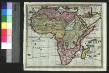
Description: Appeared in Clüver's Introductionis in Universam geographicam (first published in Leiden in 1624).,On verso: Handwritten note
Member of: Venable Maps
Resource Type: cartographic
Totius Africae accuratissima tabula
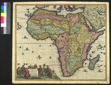
Description: On verso: Handwritten note
Member of: Venable Maps
Resource Type: cartographic
Africae accurata tabula
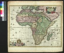
Description: This is at least the second state of the engraving: it includes the privilege in the bottom right. As such, it is no earlier than 1677, when the privilege was awarded.,On verso: Blank
Member of: Venable Maps
Resource Type: cartographic
Africae, described, the manners of their habits, and buildings newly done into English
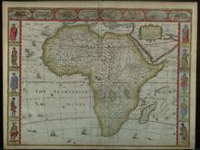
Description: On verso: Text: The Description of Africa
Member of: Venable Maps
Resource Type: cartographic
Presbiteri Johannis, sive, Abissinorum imperi descriptio
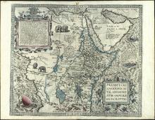
Description: Scan specification: Indus Color Book Scanner 5005 ; 600 dpi ; color ; TIFF ; lzw compressionnScan date: February 2019.nOriginal held in University Libraries Special Collections.nDate estimated from New York Public Library record.
Member of: Venable Maps
Resource Type: cartographic
Africæ : nova descriptio
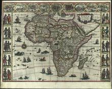
Description: Scan specification: Indus Color Book Scanner 5005 ; 600 dpi ; color ; TIFF ; lzw compressionnScan date: February 2019.nOriginal held in University Libraries Special Collections.nDate estimated from Library of Congress record.
Member of: Venable Maps
Resource Type: cartographic
Africae descriptio nova
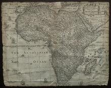
Description: filed with mounted items]; severely trimmed,On verso: Handwritten date and place
Member of: Venable Maps
Resource Type: cartographic
Map of Africa
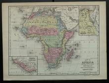
Description: Appeared in Mitchell's New Intermediate Geography (published in various editions between 1869 and 1901). Different editions were produced for different states.,On verso: Text: Asia (Arabia, Turkey in Asia, Georgia, the Asiatic Islands)
Member of: Venable Maps
Resource Type: cartographic
Africa
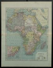
Description: Includes colonial borders and color-coding,On verso: Blank
Member of: Venable Maps
Resource Type: cartographic
Africa
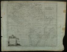
Description: Appeared in Millar's New and Universal System of Geography (1782-1785),On verso: Blank
Member of: Venable Maps
Resource Type: cartographic
Africae tabula nova
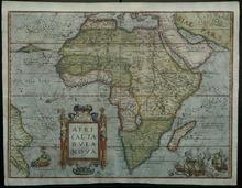
Description: Appeared in the Theatrum orbis terrarum (first published in 1570),On verso: Text: Africa
Member of: Venable Maps
Resource Type: cartographic
Africae pars borealis
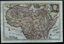
Description: Included in Scherer's posthumous Atlas Novus (1702-1710),On verso: Handwritten date and place
Member of: Venable Maps
Resource Type: cartographic
Africae pars australis
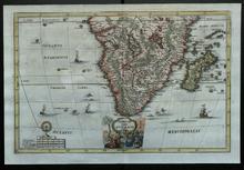
Description: Included in Scherer's posthumous Atlas Novus (1702-1710),On verso: Handwritten date and place
Member of: Venable Maps
Resource Type: cartographic
