1 - 15 of 20 records
Asie Ancienne (1812)
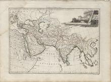
Description: Single page historical copper engraved ap of the ancient Asian Continent. The map also covers Turkey, Israel, Lebanon, Italy, Croatia, Albania, Russia, Ukraine, Crimean Peninsula, Greece, Cyprus, Arabian Peninsula, Egypt, and the Eastern Coast of African Continent. The map shows several geographic details on cities, towns, rivers, mountains, and islands. The map features a vignette of a monument incorporating the title. Cities that appear on the map include: Malao (Berbera), Somalia, Adulis, Eritrea, Berenice Troglodytica, Syene (Aswan), Nechesia, Thebae (Thebes), Myos Hormos, Memphis, and Heroapolis, Egypt, Hyerosolyma (Jerusalem), Israel, Damascus, Syria, Tyrus (Tyre), Lebanon, Amathus, Cyprus, Aelana (Aqaba), Jordan, Modiana, Rhaunathi, Iambia, Arga, Macoraba, Thebae, Gerra (Gerrha), and Uumala, Saudi Arabia, Musa, Cane (Al Mukalla), and Sabbata, Yemen, Ausara, Oman, Babylon, Iraq, Susa, Ecbatana, Rages (Rey), Aspadana (Isfahan), Persepolis, Taoce, Carmana (Kerman), Paragarda, Gagana, Iran, Ozene, Barygaza (Bharuch), Heptanesium (Bombay or Mumbai), Harmagera, Nitria, Tyndis (Kadalundi), Muziris, Barace (Purakkad), Plitana, Tagara, Modura, Calinga, Gangesegia, and Palibothra (Pataliputra), India, Thinae, Thailand, Lahoru (Lahore), Aornus (Aornos), and Taxila, Pakistan, Maracanda (Samarkand), Uzbekistan, Bactra (Balkh), and Prophthasia (Alexandria Prophthasia), Afghanistan, Phasis (Poti), Georgia, Melitene (Malatya), Antiochia (Antioch), Iconium (Konya), Gangra (Çankırı), Byzantium (Istanbul), Mazaca (Kayseri), Sardes (Sardis), and Uins, Turkey Also the unknown cities of Tadmora, Dirithotis, Pella, Tadmora, Tisa, Malana, Pattalene, Gagasmira, Issedon Scythica, Maliana, Sogdae, Arachotus, Ladissa, Trapesus, and Artucona Source publication: Atlas Complet Du Precis De la Geographie Universelle De M. Malte Brun dressee par M. Lapie Capitaine Ingenieur Geographie Pierre M. Lapie (1779-1850) and his son Alexandre Emile Lapie (1809-1850) were French cartographers and engravers active in the early part of the 19th Century. The Lapies were commissioned officers in the French army holding the ranks of Colonel and Caipitan, respectively. Alexander enjoyed the title of "First Geographer to the King", and this title appears on several of his atlases. Both father and son were exceptional engraversand fastidious cartographers. Working separately and jointly they published four important atlases, an 1811 Atlas of the French Empire (Alexander), the 1812 Atlas Classique et Universel (Pierre), the Atlas Universel de Geographie Ancienne et Modern (joint issue), and the 1848 Atlas Militaire (Alexander). They also issued many smaller maps and independent issues. All of these are products of exceptional beauty and detail. Conrad Malte-Brun (1755-1826) was an important late 18th and early 19th Century Danish/French cartographer and revolutionary. Conrad was born in Thisted, Denmark. His parents encouraged him to a career in the Church, but he instead enrolled in the University of Copenhagen. In the liberal hall of academia Conrad became an ardent supporter of the French Revolution and the ideals of a free press. Despite the harsh censorship laws of crown prince Frederick VI, Malte-Brun published numerous pamphlets criticizing the Danish government. He was finally charged with defying censorship laws in 1799 and forced to flee to Sweden and ultimately France. Along with colleague Edme Mentelle, Malte-Brun published his first cartographic work, the Geographie mathematique, physique et politique de toutes les parties du monde (6 volumes published between 1803 and 1807). Conrad went on to found Les Annales des Voyages (in 1807) and Les Annales des Voyages, de la Geographie et de l'Histoire (in 1819). He also founded the Paris Societe de Geographie. In time, Conrad became known as one of the finest French cartographers of his time.
Member of: Antiquarian Maps Collection (1603-1863)
Resource Type: cartographic
Asiae nova delineatio
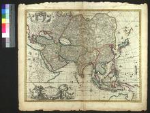
Description: Later states of the map include Visscher's privilege, awarded in 1677. The map appeared in Janson's Novus Atlas (1657-58) and in Visscher's Atlas Contractus and the Atlas Minor (first published in 1664).,On verso: Blank
Member of: Venable Maps
Resource Type: cartographic
Asia
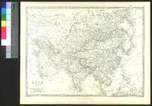
Description: Appeared in Royal Atlas of Modern Geography,On verso: Handwritten publication information
Member of: Venable Maps
Resource Type: cartographic
L'Asia
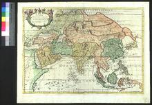
Description: Appeared in Giacomo Cantelli da Vignola's Mercurio Geografico (1668-1693),On verso: Blank
Member of: Venable Maps
Resource Type: cartographic
Asia recens summa cura delineata
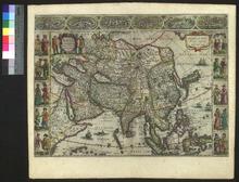
Description: The cartouche in the upper left corner had changed by 1638. The 3rd state of the plate included decorative panels below the map, but these were removed in the 4th state to accommodate inclusion in larger atlases.,On verso: Text: Asia
Member of: Venable Maps
Resource Type: cartographic
Asia noviter delineata
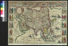
Description: Included in Blaeu's atlas with the first edition of this map appearing in 1630.,On verso: Blank
Member of: Venable Maps
Resource Type: cartographic
Asiae Nova Descriptio
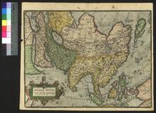
Description: Appeared in Ortelius' Theatrum Orbis Terrarum (1570). This is from the second state of the plate, as indicated by the lower-case "f" in "la farfana" to the east of Japan. The second state was used from 1574-1612.,On verso: Text: Asia
Member of: Venable Maps
Resource Type: cartographic
Indiae Orientalis, insularumque adiacientium typus
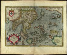
Description: Scan specification: Indus Color Book Scanner 5005 ; 600 dpi ; color ; TIFF ; lzw compressionnScan date: February 2019.nOriginal held in University Libraries Special Collections.nDate taken from WorldCat record.
Member of: Venable Maps
Resource Type: cartographic
Nieuwe Kaart van Asia
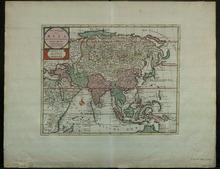
Description: On verso: Blank
Member of: Venable Maps
Resource Type: cartographic
Asia Antiqua et Nova
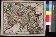
Description: Appeared in Clüver's Introductionis in Universam geographicam, first published in Leiden in 1624.,On verso: Handwritten date and place
Member of: Venable Maps
Resource Type: cartographic
L'Asie
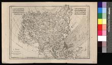
Description: Appeared in Raynal's Atlas de Toutes les Parties Connues du Globe Terrestre (ca. 1780).,On verso: Blank
Member of: Venable Maps
Resource Type: cartographic
Asia
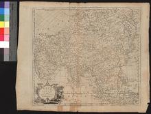
Description: Appeared in Millar's New and Universal System of Geography (1782-1785),On verso: Blank
Member of: Venable Maps
Resource Type: cartographic
Nova Asiae e tabula majori in minorem hanc formam reducta
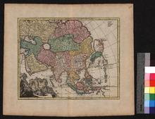
Description: Appeared in Johann David Köhler's Bequemer Schul- und Reise-Atlas (1719),On verso: Blank
Member of: Venable Maps
Resource Type: cartographic
Asia wie es jetziger zeit nach den fürnemesten Herrschafften abgetheilet und beschriben ist
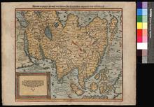
Description: On verso: Text: Asia, Die Lender Asie
Member of: Venable Maps
Resource Type: cartographic
Asia with the Islands adioyning described, the atire of the people, and Townes of importance
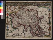
Description: Appeared in Speed's Prospect of the Most Famous Parts of the World (first published in 1627),On verso: Text: The Description of Asia
Member of: Venable Maps
Resource Type: cartographic
Pagination
- Page 1
- Next page