1 - 2 of 2 records
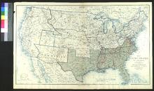
Map of the United States of America Showing the Boundaries of the Union and Confederate Geographical Divisions and Departments, June 30, 1863

Description: Appeared in The Atlas to Accompany the Official Records of the Union and Confederate Armies (1891-1895) as plate no. 167.,On verso: Blank
Member of: Venable Maps
Resource Type: cartographic
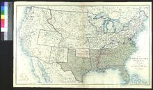
Map of the United States of America Showing the Boundaries of the Union and Confederate Geographical Divisions and Departments, June 30, 1861

Description: Appeared in The Atlas to Accompany the Official Records of the Union and Confederate Armies (1891-1895) as plate no. 163.,On verso: Blank
Member of: Venable Maps
Resource Type: cartographic