1 - 9 of 9 records
JM-166: Two unpopular Europeans
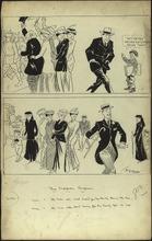
Description: This cartoon shows two European men in World War I. The first man (in the top panel) is slumping his shoulders and tries to avoid attention. He is refusing to enlist the the military, unlike the other men in his country. The caption for the top panel reads, "The man who won't enlist for his country during the war". The second man (in the bottom panel) is proudly walking past a group of women, including women who were widowed in World War I. The bottom panel is captioned, "The man who won't marry for his country after the war". Instead of getting married to help begin rebuilding society, this man proudly presents himself as a bachelor. These two men are "unpopular", because they do not conform with the sense of duty and sacrifice that was developed in Europe during and after World War I. Sacrificing oneself for one's country was seen as an honorable and moral action during this time period. (Summary created by Mary Delano, MU History Intern, Spring 2018)
Member of: McCutcheon Editorial Cartoons - ALL (Collection)
Resource Type: Still Image
Nova Europae Descriptio
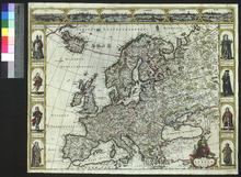
Description: Issued separately rather than as part of an atlas.,On verso: Blank
Member of: Venable Maps
Resource Type: cartographic
Europe [left half of sheet only]
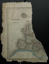
Description: Based on the dimensions, this map fragment was probably from Thomson's General Cabinet Atlas, first published in 1819.,On verso: Blank
Member of: Venable Maps
Resource Type: cartographic
Map of Europe
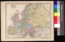
Description: Appeared in Mitchell's New Intermediate Geography (published in various editions between 1869 and 1901). Different editions were produced for different states.,On verso: Text: South America (Chili, Bolivia, Peru, Equador)
Member of: Venable Maps
Resource Type: cartographic
Novissima totius Europae in suos principaliores Status accurate divisae repraesentatio
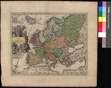
Description: Appeared in Weigel's Atlas Scholastichodoeporicus (first published 1706). Color-coded by religious denomination.,On verso: Blank
Member of: Venable Maps
Resource Type: cartographic
Europe Agreeable to the Most Approved Maps and Charts
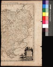
Description: Right half of sheet; likely taken from Thomas Bankes, Edward Warren Blake, and Alexander Cook's A New Royal Authentic and Complete System of Universal Geography, first appearing in 1775.,On verso: Blank
Member of: Venable Maps
Resource Type: cartographic
Europ, and the cheife Cities contayned therin described
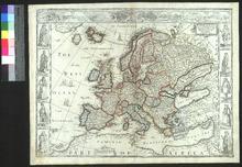
Description: On verso: Text: The Description of Europe
Member of: Venable Maps
Resource Type: cartographic
Europa recens descripta
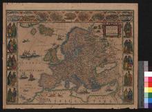
Description: On verso: Text: Europa
Member of: Venable Maps
Resource Type: cartographic
Summa Europae Antiquae Descriptio
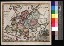
Description: Appeared in Clüver's Introductionis in Universam geographicam, first published in Leiden in 1624.,On verso: Blank
Member of: Venable Maps
Resource Type: cartographic