1 - 4 of 4 records
The Bench and bar of Boone County, Missouri: including the history of judges, lawyers, and courts, and an account of noted cases, slavery litigation, lawyers in war times, public addresses, political notes, etc.

Description: Includes index.,LSO ID: umlm000011.
Member of: Missouriana: History (Collection)
Resource Type: Text
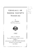
Geology of Boone County, Missouri

Description: Coal / by W. V. Searight and A. G. Unklesbay: p. 110-116.,Ground water / by J. G. Grohskopf: p. 129-142.,Bibliography: pages 143-150.,LSO ID: umlr000039.
Member of: Missouriana: Geology (Collection)
Resource Type: Text
History of Boone County, Missouri

Description: LSO ID: umlc000026
Member of: Missouriana: History (Collection)
Resource Type: Text
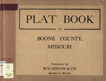
Plat Book of Boone County, Missouri

Description: Map of Boone County, Missouri -- T.46N. Part of Cedar R.11W -- T.47N. Part of Cedar R.11W -- T.48N. Part of Columbia R.11W -- T.49N. Part of Columbia R.11W -- T.49 and 50N. Part of Rocky Fork R.11W -- T.51N. Centralia R.11W -- T.45N. Part of Cedar R.11, 12 and 13W -- T.46N. Part of Cedar R.12W -- T.47N. Part of Cedar R.12W -- T.48N. Part of Columbia R.12 and 13W -- T.49N. Part of Columbia R.12 and 13W -- T.49 and 50N. Part of Rocky Fork R.12 and 13W -- T.51N. Part of Bourbon R.12W -- T.46N. Part of Cedar R.13W -- T.49N. Part of Missouri R.13W -- T.48N. Part of Missouri R.13W -- T.49N. Part of Perche R.13W -- T.50N. Part of Perche R.13W -- T.47N. Part of Cedar R.13 and 14W -- T.51N. Part of Bourbon R.13 and 14W -- T.49N. Part of Perche R.14W -- T.50N. Part of Perche R.14W -- T.48N. Part of Missouri R.14 and 15W -- T.49N. Part of Missouri R.14W.
Member of: Plat Books of Missouri (Collection)
Resource Type: cartographic