1 - 2 of 2 records
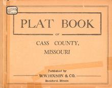
Plat Book of Cass County, Missouri

Description: Map of Cass County, Missouri -- T.42,43, and 44N. R.29W -- T.44N. Part of Index R.29W -- T.45N. R.29W -- T.46N. Part of Polk R.29W -- T.42 and 43N. R.30W -- T.44N. R.30W -- T.45N. R.30W -- T.46N. R.30W -- T.42 and 43N. Part of Austin R.31W -- T.44N. Part of Grand River R.31W -- T.45N. Peculiar R.31W -- T.46N. Big Creek R.31W -- T.43N. Everett R.32W -- T.44N. R.32W -- T.45N. West Peculiar R.32W -- T.46N. RayMissourire R.32W -- T.43N. Cold Water R.33W -- T.44N. R.33W -- T.45N. Union R.33W -- T.46N. Mt. Pleasant R.33W.
Member of: Plat Books of Missouri (Collection)
Resource Type: cartographic
History of Cass County, Missouri

Description: Includes index.,LSO ID: umls000031.
Member of: Missouriana: History (Collection)
Resource Type: Text