1 - 1 of 1 records
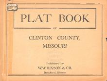
Plat Book of Clinton County, Missouri

Description: Map of Clinton County, Missouri -- T.55 and 56N. Atchison R.32 and 33W -- T.54N. Clinton R.31 and 32W -- T.55 and 56N. Concord R.31 and 32W -- T.54 and 55N. Hardin R.32 and 33W -- T.54N. Jackson R.30 and 31W -- T.56 and 57N. La Fayette R. 32 and 33W -- T.55N. Part of Lathrop R.30 and 31W -- T.56N. Part of Lathrop R.30 and 31W -- T.56 and 57N. Platte R.31 and 32W -- T.56 and 57N. Shoal R.30 and 31W.
Member of: Plat Books of Missouri (Collection)
Resource Type: cartographic