1 - 1 of 1 records
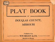
Plat Book of Douglas County, Missouri

Description: Map of Douglas County, Missouri -- T.25N. Richland R.11W -- T.26N. McKinley R.11W -- T.27N. Clinton R.11W -- T.25N. Brush Creek R.12W -- T.26N. Bryant R.12W -- T.27N. Wood R.12W -- T.25N. Jackson R.13W -- T.26N. Champion R.13W -- T.27N. Cass R.13W -- T.25N. Brown R.14W -- T.26N. McMurtrey R.14W -- T.27N. Clay R.14W -- T.25N. Walls R.15W -- T.26N. Boone R.15W -- T.27N. Miller R.15W -- T.25N. Spring Creek R.16W -- T.26N. Benton R.16W -- T.27N. Findley R.16W -- T.25N. Campbell R.17W -- T.26N. Washington R.17W -- T.27N. Lincoln R.17W -- T.25N. Port of Buchanan R.18W -- T.26N. R.18W -- T.27N. Part of Spencer.
Member of: Plat Books of Missouri (Collection)
Resource Type: cartographic