1 - 1 of 1 records
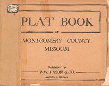
Plat Book of Montgomery County, Missouri

Description: Map of Missourintgomery County, Missouri -- T.47N. part of Bear Creek R.3 and 4W -- T.48N. part of Bear Creek R.3 and 4W -- T.49N. R.3 and 4W -- T.50N. R.3 and 4W -- T.45 and 46N. part of Loutre R.5W -- T.47N. R.5W -- T.48N. R.5W -- T.49N. R.5W -- T.50N. R.5W -- T.45 and 46. part of Loutre R.6W -- T.47N. parts of Danville and Loutre 6W -- T.48N. R.6W -- T.49N. R.6W -- T.50N. part of Upper Loutre R.6W.
Member of: Plat Books of Missouri (Collection)
Resource Type: cartographic