1 - 1 of 1 records
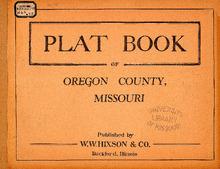
Plat Book of Oregon County, Missouri

Description: Map of Oregon County, Missouri -- T.21 and 22N. R.2W -- T.23N. R.2W -- T.24N. R.2W -- T.25N. part of King R.2W -- T.21 and 22N. R.3W -- T.23N. R.3W -- T.24N. R.3W -- T.25 and 26N. R.3W -- T.21 and 22N. part of Oak Grove R.4W -- T.23N. R.4W -- T.24N. R.4W -- T.25 and 26N. R.4W -- T.21 and 22N. part of Thayer R.5W -- T.23N. R.5W -- T.24N. R.5W -- T.25 and 26N. R.5W -- T.21 and 22N. R.6W -- T.23N. R.6W -- T.25 and 26N. R.6W -- T.24N. R.6W.
Member of: Plat Books of Missouri (Collection)
Resource Type: cartographic