1 - 1 of 1 records
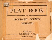
Plat Book of Stoddard County, Missouri

Description: Map of Stoddard -- T.23N. R.12E -- T.24N. R.12E -- T.25N. R.12E -- T.26N. R.12 and 13E -- T.27N. R.12 and 13E -- T.23N. R.11E -- T.24N. R.11E -- T.25N. R.11E -- T.26N. R.11E -- T.27N. R.11E -- T.28N. R.11 and 12E -- T.23N. R.10E -- T.24N. R.10E -- T.25N. R.10E -- T.26N. R.10E -- T.27N. R.10E -- T.28N. R.10E -- T.23N. R.8 and 9E -- T.24N. R.9E -- T.25N. R.9E -- T.26N. R.9E -- T.27N. R.9E -- T.24N. R.8E -- T.25N. R.8E -- T.27N. R.8E -- T.26N. R.7 and 8E.
Member of: Plat Books of Missouri (Collection)
Resource Type: cartographic