Asia Minor (1851)

Model
Image
Image
Description
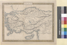
This is a steel engraved map of Asia Minor in 1851. It shows Cities, Towns, Rivers, Mountains, Lakes, and other features. John Tallis (1817–1876) was an English cartographic publisher. His company, John Tallis and Company, was in business in London from 1838 to 1851. Countries Shown on the map: Turkey, Greece, Cyprus, and Syria. Cities appearing on the map: Greece: Island of Scarpanto (Karpathos): Scarpanto (?), Avdemo (?), and Pt. Grado (?). Island of Rhodes: Kalavyah (Kattavia), M. Oros (?), Pyrgos (?), Lakanyah (Lachania), Lanathey (?), Polakah (Apolakkia), Skyanna (Siana), Phanes, Lindo (Lindos), Archangelo (Archangelos), Kalathease (Kalithies), and Rhodes. Island of Samos: Samos, Leka, and Courtotes (?). Island of Nicaria: Evthelo (Evdilos?). Island of Mytilene (Lesbos): Sigri, Liman (?), Arghena (?), Mytilene, and Scopelo (Skopelos). Island of Scio (Chios): Valisso (Volissos), Lethe (Lithi), and Kalamoti (Kalamoti). Cyprus: Stroumbi (Stroumpi), Baffa (Paphos), Carbouthi (?), Avdinio (Avdimou), Limesol (Limassol), Old Limesol (?), Pendasimo (?), Cormachitti (Kormakitis), Lapitho (Lapithos), Nicosia, Larnica (Larnaca), Cerina (?), Famagosta (Famagusta), Zdatilo (?), Amendra (?), Costro (?), and Haidar (?). Syria: Baneas (Baniyas), Jebili (Jableh), Ladikiyeh (Latakia), Serakheb (Saraqib), Emghir (?), Suriyeh (?), Herakleh (?), Rakkah (Al-Raqqah), Haji Wali (?), Toyhuk (?), Jinder Aba (?), Ak Deyavin (?), Tadef (Tedef), Meheritei (?), Hoilan (?), Aleppo, Carurabad (?), Safireh (As-Safira), and Sajur (?). Turkey: Davabourno (?), Vasilca (?), Boodroom (Bodrum), Melasso (Milas), Labrando (Labraunda), Heraclea (Herakleia), Demerjj Dere (?), Patinotiko (?), Samsoun (?), Scala Nuova (Kuşadası), Aiasaluck (Selçuk), Aidin Ghieuzel Hissar (Aydın), Claros, Cassab (Kasaba), Andiphilo (?), Suaret (?), Fornas (?), Patara, Yaloogie (?), Koonik (Kınık), Deuvar (?), Kousk (?), Ayvasil (?), Orahn (?), Makri (Fethiye), Oorloojah (?), Katra (?), Dollomon (Dalaman), Caunus (Kaunos), Keuygeeze (Köyceğiz), Olouboonar (?), Cagiolasolhucooe (?), Marmaras (Marmaris), Port Giova (Gökova), Moulinda (?), Almalee (Elmalı), Lekena (?), Yenibazar (Yenipazar), Chifteh Cafe (?), Nazeli (Nazilli), Arepas (?), Kuyuia (Kuyucak), Arrahchiflee (?), Kardsu (?), Yeerah (?), Cafe (?), Saraikieui (Sarayköy), Eski Hissar (?), Denizli, Yoomrhudas (?), Hoomarhoosarry (?), Pombuk Kaleli (Pamukkale), Chonas (?), Kaldele (?), Chardak (Çardak), Myra, Phineka (Finike), Artrasarny (Adrasan), Deliktash (?), Arycanda, Tekrova (Tekirova), Hameau (?), Adalia (Antalya), Laara (Now the District of Lara in Antalya), Bigikli (Bıyıklı), Stanisaw (?), Kara Punarkieui (?), Tshaltigshi (?), Allahsun (Ağlasun), Buldur (Burdur), Yazekieui (?), Isbarta (Isparta), Ketzi Borlou (Keçiborlu), Egerdir (Eğirdir), Kereli (Kireli), Bei Shehr (Beyşehir), Ptolemais (?), Alaya (Alanya), Silinty (?), Karadran (?), Chelindreh (Aydıncık), Selevke (Silifke), Mout (Mut), Ermenek, Sinana (?), Maiane (?), Karaman, Kizil Chesmeh (?), Ulisera (?), Cassaba (?), Chorla (?), Ak Chesha (Akçaşehir), Har Khan (?), Karabounar (Karapinar), Well (?), Well (?), Ismil (İsmil), Well (?), Elmasun (Güneysınır?), Katabothra (?), Isaura (Isauria), Kirogakieui (?), Koniyeh (Konya), Zillieh (?), Boghaz Kieui (?), Kara Bourja (?), Tris Maden (?), Kara Euran (Ortakaraören), Seidi Shehr (Seydişehir), Aufschar (?), Alan Buzuk (?), Eregli (Ereğli), Har Khan (?), Kayan (?), Bor, Nigdeh (Niğde), Kiz Hissar (?), Kolu Kushla (?), Ruined Khan (?), Guard Ho. (?), Barracks (?), Guard Ho. (?), Golek (Gülek), Mezarluk (?), Khan Vil (?), Vil (?), Adana, Ojivahli (?), Jakliguba (?), Sis, Yedezliy Kieui (?), Karasis (?), Pershendy (?), Lamas Vil. (?), Mezetli (Mezitli), Kara Hissar (?), Marsyn (Mersin), Koradouvar (?), Tarsus, Karadash Khan (Karataş), Misis (Mopsuestia), Kara Kapu (?), Ayas (Yumurtalık), Suadeiah (Samandağ), Kokson (Göksun), Belahlan (?), Marash (Kahramanmaraş), Dunkalat (?), Tartahli Koi (?), Kars (?), Urzin (?), Burnazsu (?), Yuzler (?), Boyas (?), Iskenderoon (İskenderun), Bogras (?), Sanamibli (?), Aliji (?), Aintab (Gaziantep), Arje (?), Port William (?), Eleisha (?), Andakia (Antakya), Diyar-Bekr (Diyarbakır), Severek (Siverek), Gergen Kaleh si (?), Hadro (?), Tornedah (?), Khantarah (?), Laro weran (?), Hoshun (?), Nahrlaga (?), Kerkunah (?), Oghegird (?), Somisat (?), Urfah (Şanlıurfa), Zibbili (?), Tel Jaffer (?), Tel Attchan (?), Harran, Kulleyuk (?), Arslan Tagh (?), Saruj (Suruç), Bireh jik (Birecik), Charmeli (?), Ruins (?), Adiyaman (Adıyaman), Pelvereh (Perre), Bur Konak (Börkenek), Besni, Haidli Bazar (?), Narsis (?), Zeklery Boser (?), New Troy (?), Old Troy (Troy), Alexandria (Alexandria Troas), Gura (Güre), Ichivna (?), Adraniytti (?), Sarkieup (?), Kareinkieui (Kareinkieui), Alvali (Ayvalık), Ayasmat (?), Kabakum, Pergamo (Bergama), Dekili Kieui (Dikili), Menimen (Menemen), Fouges (Phocaea), Smyrna, Vourla (Urla), Sahio (?), Murdovan (Mordoğan), Ritri (?), Latzaka (?), Soghajik (Seferihisar), Tourbali (Torbalı), Tyria (Tire), Bainder (Bayındır), Trianda (?), Ninfi (?), Cassaba (Turgutlu), Manisa, Ak Hissar (Akhisar), Kirkagatch (Kırkağaç), Bash Gelemba (?), Balikesri (Balıkesir), Umerkul (?), Meulver Kieui (?), Tash Kapou (Taşköprü), Kirmasli (?), Hdiz (?), Kefseut (?), Chiflik (?), Ahadj Hissar (?), Balat (?), Yeniji-kieui (?), Bogaditza (?), Singerli (?), Munyik (?), Ak Dagh (?), Assanler (Hasanlar), Kierkji (?), Selendi, Tefen (?), Kieui (?), Koula (Kula), Adala (?), Bin Tepeh (Bin Tepe), Sart (Sardis), Allah Sheher (Alaşehir), Aineh Ghieul (?), Sirghe (?), Aktash (?), Gueleri Kieui (?), Geuneh (Güney), Kelles (?), Debrent (?), Alamsalam (?), Bulladan (Buldan), Chindery (Cindere), Demirji-kieui (?), Seve-kieui (?), Yaessi-kieui (?), Alfachar (?), Ishekti (Çivril), Suleimanli (?), Canchas (?), Segicler (Selçikler), Sousous-kieui (Sousous), Yenisher Selendi (Yenişehir), Ushak (Uşak), Kieurkji (?), Gunenkieui (?), Yeni-kieui (Yenikent), Ghiediz (Gediz), Yeni-kieui (Gediz), Tchavdour (?), Chaji kieui (?), Gozuljah (?), Kargitash (?), Tauschanli (Tavşanlı), Mohimoul (?), Aineghuil (İnegöl), Turbeh (?), In Oghi (?), Eski Shehr (Eskişehir), Sarilar (Sarılar), Meulk (Mülkköy), Sevri Hissar (Sivrihisar), Sidi Ghazi (Seyitgazi), Kutahiyah (Kütahya), Taular (?), Altun Tash (Altıntaş), Morad Dagh (?), Usman(?), Alfiom Kara Hissar (Afyonkarahisar), Eski Kara Hissar (İscehisar?), Bolawadim (Bolvadin), Tshaktelu (?), Heraan Kaleh (?), Beiad (?), Geumek kieui (?), Hamza Hadji (?), Tchander (?), Germa, Bala Hissar (?), Barduklu (Bardakcı), Kara (?), Aslan (?), Sevin kieui (?), Saoran (?), Sandukli (Sandıklı), Deenair (Dinar), Olou Borlou (Uluborlu), Borlou (?), Yalobatch (Yalvaç?), Yeukler (?), Fn. of Midas (?), Arischar (?), Ak Hissar (?), Kani Aghatch (?), Ak Shehr (Akşehir), Arkut Khana (?), Pichankieui (?), Sarullas (?), Angora (Ankara), Yaila (?), Karghahli (Kargalı), Alif Ru (?), Kam Gedik (?), Juluk (?), Ingehsu (?), Hasan Oghlu (Hasanoğlan), Akserai (?), Sangor (?), Denek Madden (?), Banam (?), Karajiler (Karakeçili), Tol (?), Kurkli (Kırıklı), Kapa-keui (Köprüköy), Achmed (?), Sogher (?), Tash Kasman (Kaman), Kulu Kieui (Kulu), Arghun Kieui (?), Chukur Agha (?), Ilghun (Ilgın), Bedel Kaleb (?), Kadun Khaha (Kadınhanı), Ladik, Dedeler, Tuzla (?), Inya (?), In Avi (?), Iskil (Eskil), Sultan Khan (Sultanhanı), Adjem (?), Mousa Kouyou-su (?), Kodj Hissar (Şereflikoçhisar), Boghaz Kieui (Boğazköy), Sarai (?), Boghaz Kieui (Boğazkale), Nefezkieui (?), Yeuzgatt (Yozgat), Ingurly (?), Batal (?), Kislan (?), Kir Shehr (Kırşehir), Mujur (Mucur), Booslyan (Boğazlıyan), Aflok (?), Kurakum (?), Haji Kektash (Hacıbektaş), Yara-pason (?), Sari Karaman (Sarıkaraman), Taitor (?), Nenib Shehr (Nevşehir), Malagob (?), Ak Serai (Aksaray), Koyali (?), Helvar Dere (Helvadere), Sevri Hissar (Sivrihisar), Misli (?), Kara hissar (?), Ruined Khan (?), Develi, Injesu (İncesu), Kaisariyeh (Kayseri), Gomotch (?), Sultan Khan (?), Kalat Masman (?), Pallas (Palas), Sari Oghlan (Sarıoğlan), Gelermek (Gemerek), Arslan Toghmish (Arslandoğmuş), Zora (Zara), Yenijeh (Çimenyenice), Keimez (Dışkapı), Sivas, Aladja Khan (?), Kangol (Kangal), Derendah (Darende), Tanil (?), Manjutik (?), Gurum (Gürün), Karasaki (?), Chaherlasle (?), Tunuz (?), Abasilli (?), Setrek (?), Yenijah (?), Bostan (?), Sooey isury (?), Kara Kulak (?), Erzingan (Erzincan), Kemakh (Kemah), Hernemeh (?), Muselimo House (?), Devriki (?), Enden (?), Gemi Koi (?), Hoshmat (?), Palu, Egin (Kemaliye), Kharput (Elazığ), Kebban Maden (Keban), Arab-gir (Arapgir), Hakim Khan (Hekimhan), Tilkeh (?), Hogasur (Flooded by the creation of Lake Keban in 1974), Kizin (Gezin), Arghana Maden (Maden), Sardar Khan (?), Mezirah (?), Keumaur Khan (Kömürhan Bridge?), Fez Oglu (?), Gozeneh (Gözene), Sarghi (Sürgü), Malatia (Malatya), Arka (Akçadağ), Hassan Bedrik (?), Biga, Kazakti (?), Aidinjik (?), Erdek, Port Paillo (?), Ganos (Gaziköy), Kavatch (Kavakköy), Dunatika (?), Kamares (Kemer), Lampsacus (Lapseki), Burgas (?), Kippis Bouroun (Kepez), Abydos, Cas. of Europe (?), Bovalli Kallesci (?), Gallipoli, Enos (Enez), Agweh (Ağva), Mesjid Keui (?), Chileh (?), Ft. Kilios (?), Castles of Europe & Asian (Rumelihisarı and Anadoluhisarı), Pera (Now the district of Beyoğlu in Istanbul), Constantinople (Istanbul), Kntchuk Tchekmedje (Now the district of Küçükçekmece in Istanbul), Buyuk Tchekniedje (Now the district of Büyükçekmece in Istanbul), Silivri, Scutari (Now the district of Üsküdar in Istanbul), Fener Bagtche (Now the neighborhood of Fenerbahçe in Istanbul), Tuzla Kieui (Tuzla), Jarimdji (?), Izmid (İzmit), Dagirmon (?), Karamusal (Karamürsel), Ersek (Hersek), Bazarkiui (?), Iznik (İznik), Brusa (Bursa), Tartali (Tahtalı), Moudaniah (Mudanya), Yeniji Kieui (Yenikaraağaç), Ulubad (Uluabat), Karaoglankieu (Karaoğlan), Deblekieui (?), Zunguldaik (Zonguldak), Kara Bunar (Karapınar), Eregli (Karadeniz Ereğli), Pershembah (?), Shaurak (?), Alabli (Alaplı), Ak Kaya Kieui (Akkaya), Bayani (?), Akehah Shehr (?), Uskub (?), Duzchah (Düzce), Boli (Bolu), Tchagi (?), Milankaui (Melenağızı), Darikeui (Darıçayırı), Scheraf (?), Kerken Adasi (Kefken), Bahna (?), Ada Bazar (?), Khandak (?), Yarbasan (?), Armascha (?), Sabaniah (Sapanca), Kiwa (?), Terekli (Taraklı), Lefke (Osmaneli), Shughut (?), Kestabet (?), Nali Khan (Nallıhan), Kotchuk Kieui (?), Kalaijik (Kalecik), Akja Tash (?), Yayli (?), Akgharan (?), Kankiri (Çankırı), Olajik (?), Karaja Wiran (?), Tunai (?), Mironos (?), Arandi (?), Jighes (?), Eukban Aghiran (?), Jigher (?), Sahlun (?), Tcherkes (Çerkeş), Istanos (?), Kerede (Gerede), Hamanli (Hamamlı), Kastamuni (Kastamonu), Daurikan (?), Bakir Kureh si (Küre?), Chergora (?), Osmanziki (?), Bedil, Ayyanof Chilam (?), Araba Chila (?), Kara Binar (?), Zafaran Boli (Safranbolu), Naghzar (?), Dursanli (?), Ormah (?), Makin (?), Aramlah (?), Charmanli kieui (?), Filiyas (Filyos), Kizil Elmah (Kızılelma), Bartan (Bartın), Murad Bey (Muratbey), Amasserah (Amasra), Delikli Chileh (?), Kidros (?), Chideh (Cide), Uln Kereme (?), Fakoz (?), Meset (?), Kar Yani (?), Zarpana (Özlüce?), Ineboli (İnebolu), Ereni (?), Amasia (Amasya), Cauvsa (Havza?), Vizir Keuprr (Vezirköprü), Hadji Kieui (?), Aurhat Kieui (?), Khojanlik (?), Alajah (Alaca), Euyuk (Alaca Höyük), Tekiyeh Hatap (Çayhatap), Tchorum (Çorum), Mujteli (?), Osmanjik (Osmancık), Soungourli (Sungurlu), Chayan Kieui (?), Bayad (Bayat), Kurshal (?), Chai Kiui (?), Iskelib (İskilip), Tosia (Tosya), Korghi (Kargı), Durgan (?), Yuruk Yaylisi (?), Tash Kupri (Taşköprü), Iwalli (?), Arana (Abana), Stefanos (?), Kaza Kildi (Kazakyalisi?), Kaniza Kieui (?), Mehmet Bey (?), Boiavad (Boyabat), Amsoros (Amsoros Point?), Sinope (Sinop), Chobanlar (?), Gherseh (Gerze), Kousoufetova (?), Alatcham (Alaçam), Bafra, Douraan (Durağan), Chua (?), Cheltik (Çeltek), Omanagh Agbatsh (?), Isberde (?), Mellen (Mesudiye?), Isskassar (?), Bashichiflik (Başçiftlik), Ordu, Fatsa, Niksar, Denekse (?), Kuchuk Kouera (?), Herek (?), Kizil Chiflik (?), Gumenek Keupri (?), Tocat (Tokat), Boghaz Hissan Kaleh (?), Eamich (?), Thermeh (Terme), Tumulus (?), Korevli (?), Zilleh (Zile), Tourkhal (Turhal), Ladik, Charshambah (Çarşamba), Samsun, Kuru Balur (?), Koumjaas (?), Baibut (Bayburt), Balahor (?), Kerkit Chiftlik (?), Uleh Sheivan (?), Kara Hissar (Şebinkarahisar?), Kulei Hissar (?), Gumishkhana (Gümüşhane), Kerasun (Giresun), Tireboli (Tirebolu), Trebisonde (Trabzon), Givislik (?), Karakaban (Karakaban Dagi), Yanboli (?), and Kulensah (?).
Service File - Download

Mexico and Central America (1853)

Model
Image
Image
Description
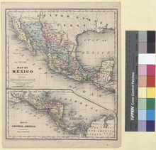
Detailed single page historical steel engraved map of Mexico and Central America published in 1853. This map depicts Colombia, Panama, Costa Rica, Nicaragua, Honduras, El Salvador, Guatemala, Belize, Mexico, and part of the United States. The map shows several geographic details on cities, towns, rivers, mountains, and islands. It measures 23.9cm by 29.3cm. Mexican States appearing on the Map: Yucatan (Yucatán, Quintana Roo, and Campeche), Tabasco, Chiapa (Chiapas), Oaxaca, Veracruz, Guerrero, La Puebla (Puebla), Mexico (Morelos, Mexico City, Hidalgo, Mexico, and Tlaxcala), Queretaro (Querétaro and San Luis Potosí), Michoacan (Michoacán and Guanajuato), San Luis Potosi (San Luis Potosí), Tamaulipas, Nueva Leon (Nuevo León), Colima, Jalisco (Jalisco and Nayarit), Zacatecas (Zacatecas and Aguascalientes), Durango, Coahuila, Cinaloa (Sinaloa), Chihuahua, Sonora, and Lower California (Baja California Sur). Cities appearing on this map include: Colombia: St. Martha (Santa Marta), Carthagena (Cartagena), and Tolu (Tolú). Panama: San Blas (San Blas Islands?), Aspinwall (Colón), Porto Bello (Portobelo), Chagres (Depopulated in 1916), Panama (Panama City), Parita, and Santiago (Santiago de Veraguas). Costa Rica: Cartago and San Jose (San José). Nicaragua: San Juan de Nicaragua or Grey Town, Blewfields (Bluefields), San Juan del Sur, Nicaragua (?), Grenada (Granada), Managua, Leon (León), Realejo (El Realejo), and Matagalpa. Honduras: Truxillo (Trujillo), Tegucigalpa, Comayagua, Choluteca, Sta. Barbara (Santa Bárbara), Omoa, and Copan (Copán). El Salvador: La Union (La Unión), San Salvador, Port Libertad (La Libertad), and Sonsonate. Guatemala: Port Istapa (Iztapa), Guatemala (Guatemala City), Isabel (Izabal), Coban (Cobán), and Quesaltenango (Quetzaltenango). Belize: Balize (Belize City) Mexico: Yucatan (Yucatán): Ichmul, Merida (Mérida), Uxmal, and Sisal. Quintana Roo: Arena (?), Balcalar (Bacalar), Campeche: Campeachy (Campeche), Champeton (Champotón), Victoria, and Laguna (Ciudad del Carmen?) Chiapa (Chiapas): Soconusco (Soconusco Region), Ciudad Real (?), and Palenque. Tabasco: Tabasco (?) Oaxaca: Oaxaca, Sta. Maria Petapa (Santa María Petapa), and Tehuantepec. Veracruz: Tuxtla (Santiago Tuxtla), Alvarado, Veracruz, Orizaba, Jalapa (Xalapa), and Tuspan (Tuxpan). Guerrero: Acapulco, Mescala (Mezcala), and Zacatula. La Puebla (Puebla): Tehuacan (Tehuacán) and La Puebla (Puebla). Mexico: Tescuco (Texcoco). Mexico City: Mexico City. Morelos: Cuernavaca. Hidalgo: Tula (Tula de Allende). Tlaxcala: Tlascala (Tlaxcala). Queretaro (Querétaro): Queretaro (Querétaro). San Luis Potosi (San Luis Potosí): Tancuahuitz (Tancanhuitz de Santos), Venado, S. Luis Potosi (San Luis Potosí), and Rio Verde (Rioverde). Michoacan (Michoacán): Patzcuaro (Pátzcuaro), Morelia, and Zamora Guanajuato: Leon (León) and Guanajuato. Tamaulipas, Victoria (Ciudad Victoria), Camargo (Ciudad Camargo), Matamoras (Matamoros), Soto la Marina, and Tampico. Nueva Leon (Nuevo León): Monterey (Monterrey). Colima: Colima (Colima City) and Guatlan (?). Jalisco: Natividad (Barra de Navidad), Autlan (Autlán), Zapotlan (Zapotitlán de Vadillo), Sayula, Guadalajara, and Lagos (Lagos de Moreno). Nayarit: Acaponeca (Acaponeta) and Tepic. Zacatecas: Tlaltenango (Tlaltenango de Sánchez Román Municipality), Sombrerete, Fresnillo, Zacatecas, and Pinos. Aguas Calientes (Aguascalientes): Aguas Calientes (Aguascalientes). Durango: Tamasula (Tamazula de Victoria), Guarisamey (?), Sta. Cruz (?), Papasquiaro (Santiago Papasquiaro), S. Juan del Rio (San Juan del Río), Durango, and Nombre de Dios. Coahuila: Parras, Alamo (?), Saltillo, Monclova, Santa Rosa (Santa Rosa de Múzquiz), San Vicente (Dismantled into the 1850s), and Guerrero. Cinaloa (Sinaloa): El Fuerte, Cinaloa (Sinaloa de Leyva), Culiacan (Culiacán), Cosala (Cosalá), and Mazatlan (Mazatlán). Chihuahua: Guadelupe (Guadalupe y Calvo), El Paso del Norte (Ciudad Juárez), Presidio del Norte (No longer in existence), Chihuahua (Chihuahua City), Sta. Cruz de Rozales (Santa Cruz de Rosales), Sta. Rozalia (Camargo), Sierra Rica (?), and Carriza (?). Sonora: Guilivis (No longer in existence), Alamo (Álamos), Guaymas, Pitic (Hermosillo), Ures, Orcasita (San Miguel de Horcasitas), Oposura (Moctezuma), and Fronteras. Lower California (Baja California Sur): La Paz and Loreto. United States of America: N. Orleans (New Orleans), Galveston, Tubac, and San Diego. A note in the Central America map states: The Panama Rail Road is 49 miles in length. It extends from Navy Bay to Panama on the Pacific. Populations for each country in 1853 are as follows: Costa Rica: 100,200 Nicaragua: 235,000 Grenada (Granada): 15,000 Leon (León): 35,000 Honduras: 310,000 Truxillo (Trujillo): 4,000 Tegucigalpa: 10,000 Comayagua: 12,000 El Salvador: 288,000 San Salvador: 16,000 Guatemala: 502,000 Guatemala City: 35,000 Belize: 11,100 Balize (Belize City): 3,000 Merida (Mérida): 15,000 Campeachy (Campeche): 9,000 Ciudad Real (?): 6,000 Tabasco (?): 7,000 Oaxaca: 25,000 Tehuantepec: 8,000 Alvarado: 1,500 Veracruz: 6,500 Orizaba: 15,000 Tehuacan (Tehuacán): 12,000 Mexico (Mexico City): 200,000 Tescuco (Texcoco): 5,000 Tlascala (Tlaxcala): 4,000 Queretaro (Querétaro): 50,000 Morelia: 18,000 Guanajuato: 40,000 Venado: 8,000 S. Luis Potosi (San Luis Potosí): 35,000 Victoria (Ciudad Victoria): 12,000 Matamoras (Matamoros): 10,000 Soto la Marina: 3,000 Tampico: 7,000 Monterey (Monterrey): 13,000 Colima (Colima City): 13,000 Autlan (Autlán): 4,000 Tepic: 10,000 Guadalajara: 50,000 Sombrerete: 7,000 Zacatecas: 30,000 Aguas Calientes (Aguascalientes): 8,000 Guarisamey (?): 4,000 Papasquiaro (Santiago Papasquiaro): 6,000 S. Juan del Rio (San Juan del Río): 12,000 Durango: 40,000 Parras: 17,000 Saltillo: 20,000 Guerrero: 1,000 Cinaloa (Sinaloa de Leyva): 9,500 Culiacan (Culiacán): 11,000 Mazatlan (Mazatlán): 1,500 Chihuahua (Chihuahua City): 15,000 Guaymas: 3,000 Pitic (Hermosillo): 8,000 Orcasita (San Miguel de Horcasitas): 2,500 Mexico: 7,662,000
Service File - Download

Map No. 7. United States (1853)

Model
Image
Image
Description
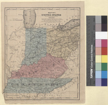
Detailed single page historical steel engraved map of the Central Great Lakes published in 1853. This map depicts Tennessee, Kentucky, Indiana, Ohio, and parts of Georgia, Alabama, Mississippi, Missouri, Illinois, Wisconsin, Michigan, Pennsylvania, Virginia (West Virginia and Virginia), and North Carolina as well as a small region of Canada. The map shows several geographic details on cities, towns, rivers, mountains, and islands. Along the bottom edge is written: Entered according to Act of Congress in the year 1853 by Daniel Burgess & Co in the Clerks office of the Southern District of New York. States appearing on the Map: Tennessee, Kentucky, Indiana, Ohio, Georgia, Alabama, Mississippi, Arkansas, Missouri, Illinois, Wisconsin, Michigan, Pennsylvania, Virginia (West Virginia and Virginia), and North Carolina. Cities appearing on the Map: Georgia: Dalton. Tennessee: Newport, Sevierville, Knoxville, Dandridge, Washington (Old Washington), Athens, Cleveland, Kingston, Benton, Madisonville, Marysville (Maryville), Smithville, McMinnsville (McMinnville), Jasper, Sparta, Pikesville (Pikeville), Harrison, Chattanooga, Lewisburg, Franklin, Murfreesboro, Shelbyvile, Fayetteville, Winchester, Woodbury, Manchester, Waynesboro, Lawrenceburg, Pulaski, Columbia, Gordon (Ghost Town), Centreville (Centerville), Bolivar, Purdy, Savanna (Savannah), Jackson, Lexington, Perryville, Huntingdon, Memphis, Raleigh (Now a community in Memphis), Somerville, Covington, Brownsville, Ripley, Trenton, Taylorsville (Name changed in 1885 to Mountain City), Elizabethtown (Elizabethton), Blountsville (Blountville), Jonesboro (Jonesborough), Greeneville, Tazewell, Rutledge, Rogersville, Montgomery (Ghost Town since 1870), Jacksboro, Clinton, Carthage, Gainesboro, Monroe, Jamestown, Springfield, Gallatin, Lebanon, Nashville, La Fayette (Lafayette), Clarksville, Charlotte, Waverly, Dover, Paris, Camden, Dresden, Dyersburg, and Troy. Kentucky: Mt. Pleasant (Name changed in 1912 to Harlan), Barboursville (Barbourville), Monticello, Williamsburg, Jamestown, Albany, Burkesville, Tompkinsville, Russellville, Franklin, Scottsville, Elkton, Hopkins V. (Hopkinsville), Cadiz, Benton, Murray, Mayfield, Hickman, Columbus, Blandville, Clinton, Piketon (Name changed in 1850 to Pikeville), Prestonburg, Whitesburg, Paintville (Paintsville), Manchester, Hazard, Jackson, Harrodsbg (Harrodsburg), Dan V. (Danville), Stanford, Liberty, Somerset, Lancaster, Richmond, Nicholas V. (Nicholasville), Mt. Vernon, London, Irvine, Elizabeth T. (Elizabethtown), Shepherds V. (Shepherdsville), Mumfords V. (Munfordville), Glasgow, Bards T. (Bardstown), Columbia, Greensburg, Campbellsville, Lebanon, Springfield, Bowling Green, Brownsville, Morgantown, Litchfield (Leitchfield), Hartford, Hardinsburg, Hawes V. (Hawesville), Princeton, Greenville, Madisonville, Owensboro, Henderson, Morganfield, Paducah, Smithland, Marion, Louisa, Grayson, Greenupsburg (Name changed in 1872 to Greenup), Mt. Sterling, West Liberty, Owings V. (Owingsville), Flemingsburg, Washington (Old Washington), Clarksburg, Maysville, Frankfort, Lawrenceb (Lawrenceburg), Versailles, George T. (Georgetown), Winchester, Lexington, Paris, Carlisle, Cynthiana, Owenton, Williams T. (Williamstown), Warsaw, Falmouth, Augusta, Taylors V. (Taylorsville), Shelby V. (Shelbyville), Louisville, La Grange, N. Castle (New Castle), Bedford, Carrollton, Brandenburg, Burlington, Covington, and Newport. Indiana: Rome, Mt. Vernon, Rockport, N. Albany (New Albany), Charleston (Charlestown), Lexington, Madison, Seymour, Vevay, Vernon, Fredonia, Corydon, Mt. Pleasant (Mount Pleasant), Paoli, Salem, Brownstown, Bedford, Harmony (New Harmony), Evans V. (Evansville), Boon V. (Boonville), Princeton, Jaspser, Petersburg, Vincennes, Washington, Lawrenceburg, Liberty, Richmond, Columbus, Versailles, Greensburg, Shelbyville, Brookville, Rushville, Conners V. (Connersville), Knights T. (Knightstown), Greenfield, Centreville, Cambridge City, New Castle, Bloomington, Nash V. (Nashville), Spencer, Martinsville, Franklin, Green Castle (Greencastle), Danville, Indianapolis, Merom, Bloomfield, Bowling Green, Terre Haute, Rockville, Newport, Decatur, Nobles V. (Noblesville), Anderson T. (Anderson), Muncie, Winchester, Portland, Hartford (Hartford City), Marion, Bluffton, Huntington, Wabash, Crawfordsville, Lebanon, Frankfort, La Fayette (Lafayette), Delphi, Kocomo (Kokomo), Peru, Logansport, Monticello, Covington, Williamsport, Rensselaer, Warsaw, Columbia (Columbia City), Ft. Wayne (Fort Wayne), Auburn, Augusta (Ghost town after 1850), Goshen, Lima (Howe), Angola, Winamac, Rochester, Plymouth, La Porte, Michigan City, South Bend, Crown Point, and Valparaiso. Illinois: Cairo, Brownsville (Ghost Town after Flooding from the Big Muddy River), Mt. Vernon (Mount Vernon), Shelbyville, Vandalia, Springfield, Danville, Pontiac, Peoria, Chicago, Juliet (Changed to Joliet in 1845), Ottawa, La Salle (LaSalle), and Dixon. Viginia (Virginia and West Virginia): West Virginia: Point Pleasant and Parkersburg. Ohio: Ironton, Gallipolis, Portsmouth, Georgetown, West Union, Chester, Marietta, McConnells V. (McConnelsville), Zanesville, Sarahs V. (Sarahsville), Woodsfield, Piketon, Jackson, McArthur, Athens, Chillicothe, Circleville, Logan, Lancaster, Columbus, Somerset, Hillsboro, Wilmington, Washington (Washington Court House), Xenia, London, Springfield, Eaton, Dayton, Hamilton, Lebanon, Batavia, Cincinnati, Bellair (Bellaire), Clairsville (St. Clairsville), Steubenville, New Lisbon (Lisbon), Cambridge, Coshocton, Cadiz, N. Philadelphia (New Philadelphia), Millersburg, Carrollton, Canton, Massilon (Massillon), Wooster, Newark, Mt. Vernon (Mount Vernon), Mansfield, Mt. Gilead (Mount Gilead), Ashland, Urbana, Marysville, Delaware, Bellefontaine, Marion, Kenton, Upper Sandusky, Bucyrus, Greenville, Troy, Sidney, Celina, Wappakonetta (Wapakoneta), Lima, Kalida, Van Wert, Canfield, Warren, Jefferson, Akron, Ravenna, Medina, Chardon, Painesville, Cleveland, Ohio City (Now a neighborhood of Cleveland it was annexed in 1854), Elyria, Norwalk, Sandusky City (Sandusky), Findlay, Tiffin, Fremont, Port Clinton, Perrysburg, Toledo, Antwerp, Defiance, Napoleon, and Bryan. Michigon: Monroe, New Buffalo, and Niles. Wisconsin: Milwaukee. Populations show on the map: Washington: 250 Tennessee: 1,003,000 Manchester: 2,000 Memphis: 8,750 Covington: 500 Brownsville: 1,000 Russellville: 1,250 Scotsville: 500 Nashville: 10,500 Camden: 250 Dresden: 1,250 Hickman: 4,500 Harrodsbg (Harrodsburg): 1,500 Kentucky: 982,000 Princeton: 750 Mt. Vernon: 1,000 Paducah: 2,500 Gallipolis: 2,250 Portsmouth: 4,000 Frankfort: 2,000 Lexington: 7,000 Augusta: 500 Louisville: 43,250 N. Albany (New Albany): 10,000 Charleston (Charlestown): 4,000 Lexington: 2,250 Madison: 8,000 Vevay: 2,000 Fredonia: 250 Corydon: 500 Paoli: 1,500 Salem: 1,250 Evans V. (Evansville): 3,500 Boon V. (Boonville): 250 Princeton: 750 Vincennes: 2,000 Washington: 2,500 Chester: 1,500 Marietta: 4,250 Zanesville: 8,000 Woodsfield: 500 Piketon: 500 Jackson: 500 Athens: 3,250 Chillicothe: 7,000 Circleville: 3,750 Logan: 750 Lancaster: 3,500 Columbus: 18,000 Somerset: 1,250 Hillsboro: 1,500 Wilmington: 1,250 Washington (Washington Court House): 500 Xenia: 7,000 London: 500 Springfield: 5,000 Newport: 6,000 Lawrenceburg: 3,500 Liberty: 1,000 Eaton: 1,250 Dayton; 11,000 Hamilton: 1,500 Lebanon: 2,000 Batavia: 2,750 Cincinnati: 115,500 Columbus: 1,500 Shelbyville: 1,000 Brookville: 3,500 Rushville: 2,750 Conners V. (Connersville): 1,000 Greenfield: 1,000 New Castle: 750 Franklin: 1,000 Green Castle (Greencastle): 1,250 Danville: 250 Bowling Green: 1,250 Newport: 500 Steubenville: 7,250 New Lisbon (Lisbon): 1,750 Cambridge: 2,250 Coshocton: 750 Cadiz: 2,500 Carrollton: 750 Canton: 4,250 Wooster: 4,250 Newark: 5,000 Mt. Vernon (Mount Vernon): 3,750 Mansfield: 3,250 Urbana: 3,500 Marysville: 500 Delaware: 3,750 Marion: 2,000 Kenton: 1,000 Bucyrus: 2,000 Ohio: 1,980,000 Decatur: 250 Greenville: 3,250 Troy: 2,000 Sidney: 1,250 Celina: 250 Lima: 750 Nobles V. (Noblesville): 1,500 Anderson T. (Anderson): 1,250 Hartford (Hartford City): 250 Marion: 750 Bluffton: 500 Huntington: 500 Crawfordsville: 1,250 Frankfort: 500 La Fayette (Lafayette): 6,250 Peru: 2,000 Indiana: 988,000 Covington: 1,250 Williamsport: 250 Canfield: 1,500 Warren: 3,000 Jefferson: 1,000 Akron: 3,250 Ravenna: 2,250 Medina: 2,000 Chardon: 1,500 Painesville: 3,000 Cleveland: 17,000 Elyria: 2,500 Norwalk: 3,250 Sandusky City (Sandusky): 5,000 Findlay: 2,000 Tiffin: 2,750 Fremont: 1,000 Port Clinton: 250 Perrysburg: 1,750 Toledo: 3,750 Defiance: 1,250 Napoleon: 500 Warsaw: 500 Goshen: 750 Lima (Howe): 1,250 Angola: 250 Rochester: 1,500 La Porte: 1,750
Service File - Download

Plan de Port-Royal et des Environs dans la Baye de Campeche (1750)

Model
Image
Image
Description
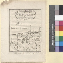
This is a map of the Bay of Campeche in Mexico published in 1750. It shows the area from the Island of Port Royal which is the modern Isla del Carmen to the Tabasco River which is the modern Grijalva River. The area is roughly the modern extreme eastern portion of Campeche State in Mexico and a small portion of extreme northern Tabasco State in Mexico. At the top of the map is the title in French: Plan de Port-Royal et des Environs dans la Baye de Campeche which translates to Map of Port Royal and Surroundings in the Bay of Campeche and at the bottom below the map is the title in Dutch: Grondtekening van Port-Royal en de Omstreeken in de Cameche Baay which translates to the same as the French title. Shown on the map are Riv. Tabasco (Grijalva River), Bras de la Riv. St. Pierre (Arm of the St. Peter River, Modern Grijalva River), Riv. St. Pierre ed St. Paul (San Pedro y San Pablo River or the River of St. Peter and St. Paul), Isle Tabasco (the area of Tabasco State in between the Grijalva River and the River and St. Peter and St. Paul), Savanes (Savannas), Lac de l'Ouest ou des Boeufs (Western Lake or Oxen Lake or modern Atasta), Lac de l'Est ou de la Crique (East Lake or Cove), Crique (Cove), I. de Buisson (Buisson Island), I. de Ferles (Ferles Island), Riv. Sumasenta, Ici etoit le Village Indien de Sumasenta (Sumasenta River, now dried up), Port Royal, Laguna Termina ou des Marees (Laguna Termina or Laguna of the Tides, Modern Laguna de Términos), Embouchure de Port Royal ou il ny a que 10 piers d'Eau (Port Royal Mouth or There are only 10 Feet of Water), Isla Port Royal (Port Royal Island, modern Isla del Carmen), Pas ou Canal (Canal), I. Triste (Sad Island, modern Isla del Carmen), Banc de Sable (?), Grande Embouchure de Port Royal ou il y a 20 piers d'Eau (Large Mouth of Port Royal or There is 20 Feet of Water), Isle de Boeufs (Isle of Oxen) (Modern Atasta Peninsula in Campeche State), and Baye de Campeche (Bay of Campeche). Jacques-Nicolas Bellin who lived from 1703 to 1772 was an important cartographer of the 18th century. He is understood as geographe de cabinet and a transitional mapmaker spanning the gap between 18th and early 19th century cartographic styles. His long career as Hydrographer and Ingénieur Hydrographe at the French Dépôt des cartes et plans de la Marine resulted in hundreds of high quality nautical charts of practically everywhere in the world. His work focuses on function and accuracy tending in the process to be less decorative than the earlier 17th and 18th century cartographic work. Unlike many of his contemporaries, Bellin was always careful to cite his references and his scholarly corpus consists of over 1400 articles on geography prepared for Diderot's Encyclopedie. In addition to numerous maps and charts published during his lifetime, many of Bellin's maps were updated (or not) and published posthumously. He was succeeded as Ingénieur Hydrographe by his student, also a prolific and influential cartographer, Rigobert Bonne. Jakob van der Schley who lived from 1715 to 1779 was a Dutch engraver and painter. He has engraved the maps and views of the maps of the Dutch edition of Prevost's Histoire General des Voyage.
Service File - Download

Belgium (1851)

Model
Image
Image
Description
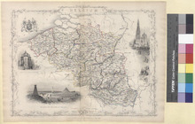
This is a steel engraved map of Belgium published in the atlas, Illustrated Atlas, by J. & F. Tallis in London in 1851. Besides the colored map of Belgium are three vignettes and the Belgian Coat of arms, all designed by J. Marchant and J. B. Allen. Provinces of Belgium Shown on the map: West Flanders, East Flanders, Hainault, Antwerp, South Brabant (Modern Flemish Brabant, Brussels-Capital Region, and Walloon Brabant), Namur, Limburg, Liege, and the Grand Duchy of Luxembourg (the Belgian province of Luxembourg and the Grand Duchy of Luxembourg). Cities appearing on the map: West Flanders: Adinekerke (Adinkerke), Houthem (Houtem), Oeren, Oostkerke, Nieucap (Nieuwkapelle), Loo (Lo), Furnes (Veurne), S. Catherine (?), Nieuport (Nieuwpoort), Westhende (Westende), Lessinghe (Leffinge), Albertin (?), Ostende (Ostend), Breedene (Bredene), Oudenburg, Jabeke (Jabbeke), Ghistel (Gistel), Sevecot (?), Cromb (?), Codaar (?), Leke, S. Peters, Sohoore, Keyhem (Keiem), Beerst, Dixnmnde (Diksmuide), Rousbrugge (Roesbrugge), Stavele, Haringhe (Haringe), Proven, Poperinghe (Poperinge), Abeele (Abele), St. Joseph (Abele), Merckhem (Merkem), Langemark, Elverdinghe (Elverdinge), S. Jans (Sint-Jan), Ypres, S. Eloy (Sint-Elooi), Reningelot (Reningelst), Wambeke (?), Messines (Mesen), Nieuwekerke (Nieuwkerke), Cnoke (Knokke), Heist, Ramskapelle, W. Kapelle (Westkapelle), Dudzeele (Dudzele), Damme, Moerkerke, Syscele (Sijsele), Assenbroek (Assebroek), Beernem, Bruges, Suivenkerke (Zuienkerke), Houtave, Blankenberg (Blankenberge), Wendune (Wenduine), Vlissegem, Ruysselede (Ruiselede), Thielt (Tielt), Winghene (Wingene), Hille, Pitthem (Pittem), Lichtervelde, Thorout (Torhout), Rudersvoorde (Ruddervoorde), Oostcamp (Oostkamp), S. Michaels (Sint-Michiels), Wynendale (?), Meulebeke, Ingelmunster, Disseghem (Desselgem), Haerlebeke (Harelbeke), Courtray (Kortrijk), Iseghem (Izegem), Roulers (Roeselare), Staeden (Staden), Cortemareq (Kortemark), Hantsaeme (Handzame), Wercken (Werken), Waerghem (Waregem), Oteghem (Otegem), Avelghem (Avelgem), Sweveghem (Zwevegem), Belleghem (Bellegem), S. Antoine (?), Coeyghem (Kooigem), Reckem (Rekkem), Bisseghem (Bissegem), Menin (Menen), Werwick (Wervik), Moorsele, Winkel S. Eloy (Sint-Eloois-Winkel), Tuymelaere (?), Roosebeke (Westrozebeke), and Staedenburg (Stadenberg). East Flanders: Maldeghem (Maldegem), Ursele (Ursel), Waerschoot (Waarschoot), Ecloo (Eeklo), Caprick (Kaprijke), Watervliet, Assenede, Bassevelde, OostEcloo (Oosteeklo), Ertvelde, Bouchoute (Boekhoute), Mendonck (Mendonk), Moerbeke, Overslag (?), Sinay (Sinaai), Stekene, Ft. S. Jean (?), S. Nicolas (Sint-Niklaas), Verrebrack (Verrebroek), Ft. Liefkenshoek, Beveren, Haasdonck (Haasdonk), Somerghem (Zomergem), Vinderhaute (Vinderhoute), Everghem (Evergem), Mariakerke, Ghent, S. Denys (Sint-Denijs-Westrem), Deurle, Bachte (Bachte-Maria-Leerne), Deynse (Deinze), Peteghen (Petegem-aan-de-Leie), Huysse (Huise), Olsenk (Olsene), Loochristy (Lochristi), Lokeren, Overmeere (Overmere), Caeleken (Kalken), Laerne (Laarne), Gontrode (Gontrode), Oosterzeele (Oosterzele), Burst (Burst), Lede, Keersmacher (Keersmaker), Hamme, Zele, Grembergen, Dendermonde, Hofstaede (Hofstade), Alost (Aalst), Welle, Oyeke (Ooike), Oudenarde (Oudenaarde), Sulsique (Zulzeke), Renaix (Ronse), Segelsem (?), S. Maria (Sint-Maria-Horebeke), Nr. Swalm (Zwalm), Brakel, Velsique (Velzeke-Ruddershove), Sotteghem (?), Vryen (Maybe Vrijheld), Grammont (Geraardsbergen), Viane, Kerexken (Kerksken), Denderhauten (Denderhoutem), Ninove, and Smerrebbe (?). Hainault: Warneton (Comines-Warneton), Dottignies, Escanaffe (Escanaffles), Pottes, Celles, Warsoing (Warcoing), Areq (Arc), Vlanine (Velaines), Melle (Melles), Obrigies (Obigies), Pecq, Kain (Kain), Ramegnies (Ramegnies-Chin), Templeuve, Marquain, Tournay (Tournai), Vaulx, Antoing, Hollain, Wadriport (Wattripont), Ainiers (Ainières), Elegnies (Ellignies), Maulde, Lenze (Leuze-en-Hainaut), Ellegnies (Ellignies-Sainte-Anne), Besacles (Basècles), Penwels (Péruwelz), Blaton, Flobecq, Ellezelles, la Hamaide (Lahamaide), Oedenghien (Oeudeghien), Vs. S. Amant (Villers-Saint-Amand), Ath, Tongre (Tongre-Notre-Dame), Auberhies (Aubechies), Beloil (Belœil), Harchies (?), S. Ghislain (Saint-Ghislain), Hensies, Quievrain (Quiévrain), Lessines, Ollegnies (Ollignies), Bassilly, Ghislenghein, Mevregnies (Mévergnies-lez-Lens), Chievres (Chièvres), Lens, Jurbise, R. Rolond (?), Mons, Gemappe (Jemappes), Poturage (Pâturages), Sart (Sars-la-Bruyère), Genly (?), Nouvelle (Nouvelles), Enghien, Thoricourt, Braine le Coamte (Braine-le-Comte), Chaussee (Chaussée-Notre-Dame-Louvignies), Soignies, Thieusies, Havre (Havré), S. Ghislain (Villers-Saint-Ghislain), Bray, Grandreng (Grand-Reng), BellesTetes (?), Naast, Meignault (Mignault), Roeulx (Le Rœulx), le Hestre (?), Rosignies (?), Liberchies, Frasne (Frasnes-lez-Gosselies), Villers (Villers-Perwin), Ligny, Fleurus, Gosselies, Gilly, Trazegnies, Courcelle (Courcelles), Charleroy (Charleroi), Binch (Binche), Aldegonde (?), Anderlues (Anderlues), Merbes le Chat (Merbes-le-Château), Thuin, Ragnee (?), Stree (Strée), Ham (Ham-sur-Heure-Nalinnes), Gerpinnes, Beaumont, Leugnies, Relournaut (?), Xivry (Sivry), Ranse, Lorson (?), Robechies, Chimay, S. Remy (Saint-Remy), Forges, and Seloigne (Seloignes). Antwerp: Zwyndrecht (Zwijndrecht), Santvliet (Zandvliet), Stabroek, Ft. Lillo (Fort Lillo), F. S. Philip (Fort van Sint-Filips), Antwerp, Esschen (Essen), Achterbroek, Zilver Hodeje (?), Putten (Putte), Capelle (Kapellen), Braeschaet (Brasschaat), Wynigem (Wijnegem), Halle, S. Antonius (Sint-Antonius), Westmalle, Gr. Veerle (Groot-Veerle), Meerle, Meer, Minderhout, Loenhout, Brecht, Hoogstraeten (Hoogstraten), Rykvorsel (Rijkevorsel), Hoek (?), Oostmalle, Vlimmeren, Gierle, Severdonck (Gene-Zevendonk), Oude (Oud-Turnhout), Turnhout, Merexplas (Merksplas), Geheul, Sterte (?), Poppel, Welde (Weelde), Billevleen (?), Voorheide (Part of Pleintje now), Postel, Arendonk, Rethy (Retie), Dessel, S. Amants (Sint-Amands), Thisselt (Tisselt), Willebroeck (Willebroek), Paers (Puurs), Haesdonek (?), Boom, Conticq (Kontich), Wilryck (Wilrijk), Mortsel, Vreemde (Vremde), Mechlen (Mechelen), Peulus (Peulis), S. C. Waever (Sint-Katelijne-Waver), Duffell (Duffel), Lier, Nazareth (Nazaret), Embleken (Emblem), Kessel, Gnestel (Gestel), Viersel, Schrick (Schriek), Beersel (Beerzel), Itegem, Grobbendonck (Grobbendonk), Herenthals (Herentals), St. Gomar (?), Noorderwyck (Noorderwijk), Morkhoven, Westerloo (Westerlo), Herselt, Tongerloo (Tongerlo), Oevel, Oolen (Olen), Lichtaert (Lichtaart), Aert (?), Hesse (?), Geel, Gestel, Moll (Mol), Baelen (Balen), and Merhout (Meerhout). South Brabant (Modern Flemish Brabant, Brussels-Capital Region, and Walloon Brabant): Modern Flemish Brabant: Steenuffel (Steenhuffel), Opwyk (Opwijk), Mollem, Assche (Asse), Londerseel (Londerzeel), Wolverthem (?), Vilvorde (Vilvoorde), Elewyt (Elewijt), Melsbroeck (?), Bucken (Buken), Haeght (Haacht), Betecom (Betekom), Aerschot (Aarschot), Vrouwe Perck (?), S. Joriswinge (Sint-Joris-Winge), Averbeden, Sichem (?), Montague (?), Beckevoort, Betz (?), Cortenaecken (Kortenaken), Haelen (Halen), Diest, Rummen (?), S. Pierre (Sint-Pieters-Kapelle), Vollezeeles (Vollezele), Herinnes (Herne), Lerbeeck (Leerbeek), Castre (?), Elingen, S. M. Lennick (Sint-Martens-Lennik), Wambeke (Wambeek), Alsembergh (Alsemberg), Linkenbeek (Linkebeek), Tervueren (Tervuren), Kortenberg, Overyssche (Overijse), Neryssche (Neerijse), Tombeek, Leefdael (Leefdaal), Winxel (Winksele), Corbeeck (Korbeek-Dijle), Louvain (Leuven), Vlanden (Blanden), Hougaerde (Hoegaarden), Tirlemont, (Tienen) Binkom (Binkom), Clabbeeke (Glabbeek), Leau (Zoutleeuw), and Hal (Halle). Modern Brussels-Capital Region: Anderlecht, Brussels, Schoneburg (?), Heembeek, and Woluwe (Woluwe-Saint-Lambert). Modern Walloon Brabant: Hamme (Hamme-Mille), Bossut (Bossut-Gottechain), Grez (Grez-Doiceau), Mellain (Mélin), Rebeckque (Rebecq), Saintes, Tubic (Tubize), Chat (Braine-le-Château), Waterloo, Hougomont (Hougoumont), Bois Sr. Isaac (Bois-Seigneur-Isaac), Orival (Bois d' Orival), Nivelles, Mt. St. Jean (Mont-Saint-Jean), Ohain, la Belle Alliance (La Belle Alliance), Planchenoit (Plancenoit), Genappe, Quartre Bras, Marbais, Wavre, Limale (Limal), Mt. St. Guibert (Mont-Saint-Guibert), Cour S. Ettienne (Court-Saint-Étienne), Rx. Miroir (Roux-Miroir), Opprebais, Orbois (Orbais), Perwez le Marche (Perwez), Jodoigne, Glimes, Jauche, and Ramillies. Namur: Gonrieux, Oigny (?), Couvin, Frasne (Frasnes-lez-Couvin), Oloy (Olloy-sur-Viroin), Mariembourg, Dourbes, Roly, Mattaigne (Matagne-la-Grande/Matagne-la-Petite), Sautour, Surice, Philippeville, Franchimont, Slenrieux (Silenrieux), Rosee (Rosée), Florenne (Florennes), Walcourt, Gourdinne, Tarsienne (Tarcienne), Hansinne (Hanzinne), S. Gerard (Saint-Gérard), Mariame (Morialmé), Stave, Leroux (Le Roux), Corenne, Serville, Wiellen (Weillen), Bouvignes (Bouvignes-sur-Meuse), Senenne (?), Barnot (Burnot), Bois de Villers (Bois-de-Villers), Fosse (Fosses-la-Ville), Malogne (Malonne), Florette (Floreffe), Ligny, Onos (Onoz), Temploux, Risnes (Rhisnes), Botey (Bothey), Avelle (Ardenelle?), Erfnage (Ernage), Gembloux, Sauveniere (Sauvenière), Dhuy, Leuze, Champion, Frisee (?), Namur, Bonnines (Boninne), Seilles, Andenne, Thon, Maiseronle (?), Tombes (Faulx-Les-Tombes), Loyers, Andoy, Geronsart (?), L'Agneau (?), Assesse, Floree (Florée), Jassogne, Nattoie (Natoye), Godinne, Hubinne, Emptinne, Ciney, Awagne, Thine (Thynes), Sorinne (Sorinnes), Achin (Achêne), Dinant, Custine (Custinne), Seminchamps (?), S. Remy (?), Mentil S. Blaise (Mesnil-Saint-Blaise), Eglise (Mesnil-Église), Houjet (Houyet), Wanlin, Bardonville (Baronville), Beauraing, Severy (Sevry), Veneiche (Vonêche), Ave (Ave-et-Auffe), Rochefort, Wellin, Chanly, Barzin, Neupont, Daverdisse, Malvoisin, Villerzies (Willerzie), Gedinne, Porcheresse, Graide, Gosne (Goesnes), Havelange, Bachelle, Somme (Somme-Leuze), Noiseaux, Sensain (Sinsin), Hogne, Martin (?), Orchimont, and Sugny. Limburg: Lommel, Achel, Haverbeck (?), Hamont (Hamont-Achel), Nether Pelt (Neerpelt), Over Pelt (Overpelt), Kautille (Kaulille), KL Breugel (Kleine-Brogel), Excel (Eksel), Hechtel (Hechtel-Eksel), Wechmael (Wijchmaal), Peer, Bree, Eelicum (Ellikom), GrRoy (Gruitrode), Hoef, Helchteren (Houthalen-Helchteren), Op Hoven (Ophoven, Maaseyck (Maaseik), Rothem (Rotem), Ft. Op Oeteren (Opoeteren), Ob Glabbeeck (Opglabbeek), Hingelhoef (?), Winterslag, Niel (Now a part of As), Asch (As), Wucht (?), Stockem (Dilsen-Stokkem), Mecheln (Maasmechelen), Reckem (Rekem), Haren (Neerharen), Ghenck (Genk), Diepenbeek, Beyerst (Beverst), Bilsen (Bilzen), Corspel (Korspel), Oostham (?), Coursel (Koersel), Houthalen (Houthalen-Helchteren), Tessenderlen (Tessenderlo), Beringen, Solder (Zolder), Berekenin (Berkenen), Bolderberg, Linchout (Linkhout), Haelen (Halen), Herek (Herk-de-Stad), Hasselt, Cosen (Kozen), Cortenhasch (Kortenbos), Alcken (Alken), Guichoven (Guigoven), Vletoghem (Vlijtingen), Rymps (Riemst), Tongres (Tongeren), Ob Repe (?), Looz (Borgloon), Keers (Heers), Wellen, S. Tron (Sint-Truiden), Brusthem (Brustem), Ailst (Aalst), Gelinden (Gelinden), Wellem (Velm), Borlo, and Frezin (?). Liege: Wassiege (Wasseiges), Wonck, Landen, Hallet (Petit-Hallet or Grand-Hallet), Hannut, Jere (Geer), Turine (Tourinne), Mefrle (Meeffe), Fumat (Fumal), Hucorgne (Huccorgne), Moha, Venam (?), Villers (Villers-le-Bouillet), Bodegnee (Bodegnée), Celle (Celles), Gd. Hacq (Grand-Axhe), Doncel (Donceel), Chock (Chokier), Hologne (Grâce-Hollogne), Nouville (Noville), Warem (Waremme), Lantremonge (Lantremange), Lens (Lens-sur-Geer), Fize (Fexhe-le-Haut-Clocher), Liege (Liège), Rocour (Rocourt), Juprelle, Haccour (Haccourt), Vise (Visé), Mortier, Housse, Jupille (?), Aubel, Clermont, Herve, Batice (Battice), Soumagne, Aulne (Olne), Limburg (Limbourg), Verviers, Theux, Poleur (Polleur), le Sort (Sart), Spa, Francorchamp (Francorchamps), Stavelot, Gleize (La Gleize), Nonceveux, Leray (La Reid), Louvaigne (Louveigné), Sougnez (Sougné-Remouchamps), Sprimont, Esneux, Beaufay (Beaufays), Wane (Wanne), St. Vith, Basse Rodeux (Basse-Bodeux), Chevron, Lierneux, Ferriere (Ferrières), My, Harze (Harzé), Ivot (Ivoz-Ramet), Avister, S. Severin (Saint-Séverin), Fraigneux (Yernée-Fraineux), Nandrin, Neuville (Neuville-sous-Huy), Soxhet (Xhos), Comblain (Comblain-au-Pont), Ouffet, Lenche (Linchet), Terwagne, Huy, Vile (Vyle-et-Tharoul), Avain (Les Avins), Pailhe, Bois, and Clavier. Luxembourg: Redu, Transinne, Gr Holleux (Grand-Halleux), Salm Chat (Salm-Château), Comonster (Commanster), Behault (Beho), S. Martin (?), Sterpigny, Alt Salm (Vielsalm), Sart (Petit-Sart), Hare, Heid (Heyd), Bomal, Durbuy, Biron (Bîron), Erezee (Érezée), Melreux, Rendeux, Marie (?), Marcourt, la Roche (La Roche-en-Ardenne), Fronville, Marenne, Marche (Marche-en-Famenne), Roy, Bande, Halleux, Vecquemont (Vecmont), Hubermont, Warempage, Cena (Cens), Tenneville, Bellevue (Belle-Vue), Nassogne, Neuville (Laneuville-au-Bois), Avenne (Awenne), Grupont, Arville, S. Hubert (Saint-Hubert), Smuid, Libbinbos (Libin-Bas), Romagne (Remagne), Rondu, H. Bras (Bras la Haute), B. Bras (Bras la Basse), Maissin, Ourth (Ourthe), Steinbach, Novelle (Noville), Wicourt, Long Champs (Champs), Fraiture, Bihain, Tailles (Petites-Tailles), S. Urban, Fontenaille, Houfalize (Houffalize), Engreaux (Engreux), Roumont (Roûmont), Flamizoul (Flamisoul), Flamierge, Louville (?), Hemroule (Hèm'roûle), Bastogne, Houmout (Hoûmont), Villeroux, Loutrebois (Lutrebois), Mohet (Morhet), Loutremange (Lutremange), Messancy, Buvange, Weyler, Arlon, Heischling (?), Attert, Tintange, Redst (?), Warnach, Strinchamp (Strainchamps), Hollange, Remichampagne, Burnan, Vaulx les Rosiere (Vaux-les-Rosières), Neuville (Laneuville), Verlaine, Neuvillers, Rosart (Rôssart), Neufchateau (Neufchâteau), Bertrix, Auby (Auby-sur-Semois), Palizeru (Paliseul )l, Mergny (Merny), Mogimont, Belvaux (Bellevaux), Bouillon, S. Cecile (?), Martilly, Chiny, Florenville, Villers d'Orvat (Villers-devant-Orval), d'Orval (Ab d'Orval), Velansart (Valansart), Izel, Asnoix (Assenois), Thibesart (Thibessart), Rossignol, Tintigny, Meix (Meix-devant-Virton), Etale (Étalle), Fauxvillers (Fauvillers), l Eglise (Léglise), Becheme (Behême), Anlier, Habay le Neuve (Habay-la-Neuve), Hachy, Chartenelle (Chantemelle), Valansart (Vlessart), Heemsteert (Heinstert), Virton, Ethe (?), and Signeux (Signeulx). France: Dunkirk, Armentieres (Armentières), Conde (Condé-sur-l'Escaut), Valenciennes, Maubeuge, Avesnes (Avesnes-sur-Helpe), Charlemont (Fort de Charlemont), Givet, Sierck (Sierck-les-Bains), Longwy, Mezieres (Charleville-Mézières), Sedan, and Montmedy (Montmédy). Netherlands: Sasvan Gent (Sas van Gent), Flushing (Vlissingen), Cadzand, Cassandria (?), Sluis, Oostburg, Aardenburg, Terneuse (Terneuzen), Axel, Hulst, Bergen op Zoom, Breda, Venlo, and Roermond. Germany: Aix-la-Chapelle (Aachen) and Dasbourg (Dasburg). Grand Duchy of Luxembourg: Ob Beslingen (Hautbellain), Weise Wampach (Weiswampach), Busbellain (Basbellain), Hachville (Hachiville), Sassel, Heinerscheyd (Heinerscheid), Clervaux, Hosingen, Allerhorn (Allerbur), Doningen (Doennange), Dernbach (Derenbach), Holzthum, Gelbom (?), Wiltz, Soule (?), Harling (Harlange), Berl (Berlé), Kaundorf, Esch (Esch-sur-Sûre), Eschdorf, Gralingen, Michelau, Bettendorf, Diekirch, Ettelbruck, Vianden, Haller, Echternach, Ostweiler (Osweiler), Born, Feltz (?), Consdorf, Hirsburg (?), Beydweiller (Beidweiler), Betsdorf (Betzdorf), Grevenmachern (Grevenmacher), Rodt (Roodt-sur-Syre), Junglinster, Burglinsten (Bourglinster), Auwen (?), Beyren, Sandweiler, Wormeldange, Bous, Remich, Schengen, Dalheim, Tettinghen (Tétange), Bettemburg (Bettembourg), Alzingen, Hesperange, Luxembourg (Luxembourg City), Eich (Eich, a quarter in Luxembourg City), Valserlingen (?), Helmdingen (Helmsange), Lintgen, Rollingen, Mersch, Pittingen (Pettingen), Useldange, Berg, Mertzig, Belvoux (Belvaux), Differdange, Clemancy (Clemency), Pissingen (Piseng), Nr. Eller (?), Capweiler (Kapweiler), Beckerich, Ooperen (?), Grosbous, Holz, and Sirret (Surré). In the upper left corner of the map is the Coat of Arms of Belgium. In the left central part of the map, there is a vignette entitled Altar of St. Gudule, Brussels. This Altar is located within the Cathedral of St. Michael and St. Gudula in Brussels. In the lower left corner of the map there is a vignette entitled Monuments on the Plains of Waterloo. These monuments commemorate the battle that took place on June 18, 1815 in which Napoleon Bonaparte was defeated. The entire right side of the map is a vignette entitled Antwerp Cathedral showing the Cathedral of Our Lady in Antwerp with a religious procession. John Tallis was an English cartographer and publisher who lived from 1817 to 1876 and published from the 1830s to the 1850s in London at his company J. & F. Tallis & Co.
Service File - Download

Carte du Chemin de Ust-Kameno-Gorsk jusque' aux Ruines d' Ablaikit (1779)

Model
Image
Image
Description
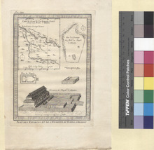
This is an engraving of the Buddhist Monastery of Ablaikit and a map of the location of the ruins published in 1779. The map shows the city of Ust-Kameno-Gorsk (Oskemen) in Kazakstan as are the Monastery ruins. In the upper left is a map of the area of Kazakstan containing the ruins with the French title: Carte du Chemin de Ust-Kameno-Gorsk jusqu' aux Tuines d' Ablaikit which translates to Map of Ust-Kameno-Gorsk and Path to the Ruins of Ablaikit. In the upper right is a map of the Monastery grounds with a title in French: Plan de l'Enceinte des Murs du Temple d'Ablaikit which translates to Map of the Temple Walls of Ablaikit. In the bottom section is an image of the Monastery and Temple itself. In French is Plan du Temple which translates to Temple Map showing a plan of the inner temple. There is also a detailed image of the Monastery and Temple with the French title Elevation du Temple d'Ablaikit which translated to Elevation of the Temple of Ablaikit. Below the map is the French title Plan des Environs et de L'Enceinte du Temple D'Ablaikit which translated to plan of the Temple and Surroundings of Ablaikit. Jacques-Nicolas Bellin who lived from 1703 to 1772 was an important cartographer of the 18th century. He is understood as geographe de cabinet and a transitional mapmaker spanning the gap between 18th and early 19th century cartographic styles. His long career as Hydrographer and Ingénieur Hydrographe at the French Dépôt des cartes et plans de la Marine resulted in hundreds of high quality nautical charts of practically everywhere in the world. His work focuses on function and accuracy tending in the process to be less decorative than the earlier 17th and 18th century cartographic work. Unlike many of his contemporaries, Bellin was always careful to cite his references and his scholarly corpus consists of over 1400 articles on geography prepared for Diderot's Encyclopedie. In addition to numerous maps and charts published during his lifetime, many of Bellin's maps were updated (or not) and published posthumously. He was succeeded as Ingénieur Hydrographe by his student, also a prolific and influential cartographer, Rigobert Bonne. Jakob van der Schley who lived from 1715 to 1779 was a Dutch engraver and painter. He has engraved the maps and views of the maps of the Dutch edition of Prevost's Histoire General des Voyage.
Service File - Download

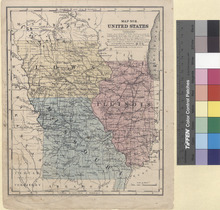
Map No. 8. United States (1853)

Model
Image
Image
Description
Detailed single page historical steel engraved map of the Eastern Midwestern States published in 1853. This map depicts Illinois, Missouri, and Iowa and parts of Kentucky, Arkansas, Indian Territory (Oklahoma), Kansas, Nebraska, Minnesota, Wisconsin, and Indiana. The map shows several geographic details on cities, towns, rivers, mountains, and islands. Along the bottom edge is written: Entered according to Act of Congress in the year 1853 by Daniel Burgess & Co in the Clerks office of the Southern District of New York. States appearing on the Map: llinois, Missouri, Iowa, Kentucky, Arkansas, Indian Territory (Oklahoma), Kansas, Nebraska, Minnesota, Wisconsin, and Indiana. Cities appearing on the Map: Missouri: New Madrid, Bloomfield, Crane Creek (Cane Creek Township), Van Buren, Thomasville, Rock Bridge (Rockbridge), Forsyth, Cassville, Enterprise (No longer exists but was on the banks of Pattersons Creek in McDonald County), Neosho, Charleston, Benton, Jackson, Perryville, Greenville, Berford (?), Fredericktown, Farmington, Potosi, St. Genevieve (Ste. Genevieve), Eminence, Houston, Birchport (?), Hartville, Waynesville, Mt. Vernon (Mount Vernon), Springfield, Greenfield, Buffalo, Bolivar, Fremont (Name changed to Stockton in 1857), Carthage, Batesville (Ghost town after 1848), Herculaneum, Hillsboro, St. Louis, St. Charles, Steeleville (Steelville), Linn, Union, Herman (Hermann), Warrenton, Danville, Erie (Ghost town after 1855 when the county seat moved to Linn Creek), Tuscumbia, Versailles, Jefferson City, Fulton, Boonville, Columbia, Franklin, Oceola (Osceola), Warsaw, Clinton, Georgetown, Warrensburg, Harrisonville, Troy, Mexico, Bowling Green, New London, Hannibal, Palmyra, Marion City (Ghost town), Fayette, Glasgow, Paris, Huntsville, Keytesville, Shelbyville, Bloomington, Marshall, Lexington, Carrollton, Chillicothe, Linneus, Gallatin, Independence, Liberty, Richmond, Platte City, Plattsburg, Sparta (Ghost town after the county seat moved to St. Joseph in 1846), St. Joseph, Kingston, Savannah, Westport (Now a neighborhood in Kansas City since 1897), Oregon, Monticello, Waterloo, Edina, Hopkinsville (Kirksville), Memphis, Tippecanoe (Ghost town after the civil war), Trenton, Pharsalia (Name changed to Milan in 1859), Princeton, Sandsville (Ghost town before 1882), Bethpage (Bethany), and Lindon (Ghost town). Illinois: Metropolis City (Metropolis), Golconda, Elizabethtown, Shawneetown (Abandoned after the 1937 Flood of the Ohio River and now known as Old Shawneetown), Equality, Cairo, Caledonia (Ghost town since 1870), Union (Unity), Vienna, Jonesboro, Brownsville (Ghost town after fire burned the court house down in 1843), Marion, Kaskaskia, Mt. Carmel (Mount Carmel), Lawrenceville, Carmi, McLeansboro, Albion, Fairfield, Olney, Lewisville (Name changed to Louisville), Newton, Salem, Benton, Pinckney V. (Pinckneyville), Nashville, Mt. Vernon (Mount Vernon), Carlyle, Greenville, Waterloo, Belleville, Edwardsville, Alton, Grafton, Palestine, Marshall, Paris, Ewington (Ghost town after 1860 when the county seat moved), Shelbyville, Charleston, Sullivan, Vandalia, Hillsboro, Taylorsville (Taylorville), Decatur, Springfield, Gilead, Jerseyville, Carrollton, Carlinville, Pittsfield, Winchester, Jacksonville, Virginia, Mt. Sterling (Mount Sterling), Quincy, Danville, Middleport (Middleport Township), Monticello, Urbanna (Urbana), Pontiac, Petersburg, Postville (Ghost town after the county seat moved to Mt. Pulaski in 1848), Clinton, Bloomington, Tremont, Woodford, Peoria, Rushville, Havanna (Havana), Lewiston (Lewistown), Macomb, Monmouth, Knoxville, Carthage, Nauvoo, Oquawka, Chicago, Morris, Ottawa, Joliet, Yorkville, Napiersville (Naperville), Syracuse (Sycamore), Batavia, Toulon, Lacon, Hennepin, Princeton, Dixon, Oregon City (Name changed to Oregon in 1843), Cambridge, Rock Island, Lyndon, Waukegon (Waukegan), Dorr (Dorr Township), Belvidere, Rockford, Freeport, Mt. Carroll (Mount Carroll), and Galena. Indiana: Terre Haute, Kansas: Ft. Leavenworth (Fort Leavenworth). Iowa: Keokuck (Keokuk), Ft. Madison (Fort Madison), Burlington, Bloomfield, Keosauga (Keosauqua), Centreville (Centerville), Leon, New Buda, Avon (Ghost town), Clarinda, Sidney, Davenport, DeWitt, Mt. Pleasant (Mount Pleasant), Wapello, Washington, Muscatine, Iowa City, Tipton, Fairfield, Albia, Ottumwa, Oskaloosa, Lancaster (Ghost town after 1904), Montezuma, Marengo, Chariton, Oceola (Osceola), Knoxville, Winterset, Indianola, Fort Des Moines (Des Moines), Newton, Adell (Adel), Mt. Vernon (?), Quincy, Aftan (Afton), Pisgah (Mount Pisgah was a Mormon settlement that became a ghost town as the settlers moved west to Utah after 1852), Lewis, Panora, Glenwood, Kanesville (Council Bluffs), Council Bluff (Council Bluffs), Magnolia, Bellevue, DuBuque (Dubuque), Marion, Anamosa, Delhi, Prairie la Porte (Name changed to Guttenberg in 1851), Garnavillo, West Union, Toledo, Vinton, Cedar Falls, Waverley (Waverly), Clarksville, Marietta (Marietta Township), Nevada, Boonsboro (Annexed to Boone, Iowa in 1887), Homer (Ghost town after the county seat was moved to Fort Dodge in 1856), Eldora, De Korrah (Decorah), Wawkon (Waukon), and Ft. Atkinson (Fort Atkinson). Nebraska: Omaha City (Omaha). Wisconsin: Milwaukee. Minnesota: Ft. Snelling (Fort Snelling) and St. Paul (Saint Paul). The Indian Territory (Oklahoma) shows the Native American tribe of the Cherokees. Kansas shows the Native American tribes of the Osages, the Potawatomies, Sauks, Kickapoos, Delawares, and Kansas. Nebraska shows the Native American tribes of the Ottoes and the Omahas. Populations shown on the map: New Madrid: 1,500 Shawneetown: 1,500 Equality: 750 Caledonia: 250 Vienna: 250 St. Genevieve (Ste. Genevieve): 2,250 Missouri: 682,000 Springfield: 500 Mt. Carmel (Mount Carmel): 1,000 Albion: 250 St. Louis: 77,750 St. Charles: 2,750 Belleville: 3,000 Edwardsville: 750 Alton: 4,000 Grafton: 500 Herman (Hermann): 1,000 Danville: 1,250 Jefferson City: 1,250 Fulton: 3,000 Columbia: 3,250 Boonville: 2,250 Warrensburg: 1,250 Marshall: 1,250 Springfield: 4,500 Gilead: 500 Jerseyville: 750 Carrollton: 750 Winchester: 750 Jacksonville: 2,750 Palmyra: 1,250 Quincy: 7,000 Keytesville: 1,500 Shelbyville: 250 Lexington: 3,750 Chillicothe: 500 Gallatin: 1,500 Richmond: 2,500 Platte City: 500 St. Joseph: 1,000 Danville: 500 Illinois: 851,000 Peoria: 5,500 Rushville: 2,500 Lewiston (Lewistown): 1,500 Knoxville: 500 Keokuck (Keokuk): 2,500 Ft. Madison (Fort Madison): 1,500 Burlington: 5,250 Edina: 250 Bloomfield: 1,000 Chicago: 30,000 Morris: 500 Joliet: 2,750 Batavia: 1,000 Hennepin: 500 Oregon City (Name changed to Oregon in 1843): 500 DeWitt: 750 Mt. Pleasant (Mount Pleasant): 750 Wapello: 750 Washington: 750 Muscatine: 2,500 Iowa City: 1,500 Fairfield: 1,500 Fort Des Moines (Des Moines): 333 Iowa: 192,000 Waukegon (Waukegan): 3,000 Freeport: 2,000 Mt. Carroll (Mount Carroll): 500 Galena: 6,000 Bellevue: 750 DuBuque (Dubuque): 3,000
Service File - Download

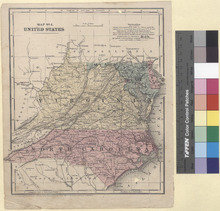
Map No. 4. United States (1853)

Model
Image
Image
Description
Detailed single page historical steel engraved map of the Southern Mid Atlantic States published in 1853. This map depicts North Carolina, Virginia (Virginia and West Virginia), Maryland as well as the District of Columbia, and Delaware, and parts of South Carolina, Georgia, Tennessee, Kentucky, Ohio, and Pennsylvania. The map shows several geographic details on cities, towns, rivers, mountains, and islands. Along the bottom edge is written: Entered according to Act of Congress in the year 1853 by Daniel Burgess & Co in the Clerks office of the Southern District of New York. States appearing on the Map: North Carolina, Virginia (Virginia and West Virginia), Maryland, Delaware, South Carolina, Georgia, Tennessee, Kentucky, Ohio, and Pennsylvania as well as the District of Columbia. Cities appearing on the Map: North Carolina: Smithville (Name changed to Southport in 1887), Beaufort, Kenansville, Onslow C. H. (?), S. Washington (Ghost Town), Wilmington, Whitesville (Whiteville), Elizabeth (Elizabethtown), Lumberton, Rockingham, Wadesboro, Columbia, Plymouth, Williamston, Washington, Newbern (New Bern), Trenton, Kingston (Kinston), Goldsboro, Snow Hill, Greenville, Tarboro, Nashville, Windsor, Clinton, Fayetteville, Smithfield, Raleigh, Chapel Hill, Carthage, Lawrenceville (Ghost Town soon after 1842), Pittsboro, Ashboro, Monroe, Albemarle, Concord, Charlotte, Dallas, Lincolnton, Salisbury, Statesville, Lexington, Mocksville, Lenoir, Morgantown (Morganton), Shelby, Rutherfordton, Burnsville, Hendersonville, Ashville (Asheville), Waynesville, Franklin, Murphy, Eliz. City (Elizabeth City), Hertford, Gatesville, Edenton, Winton, Jackson, Halifax, Gaston, Louisburg, Oxford, Warrentown (Warrenton), Roxboro, Hillsboro (Hillsborough), Greensboro, Yanceyville, Wentworth, Salem, Wilkesboro, Germanton, Rockford, and Jefferson. South Carolina: Marion, Cheraw, Camden, Columbia, Yorkville (Name changed to York in 1915), Laurensville (Name changed to Laurens in 1873), Greenville, Abbeville, and Anderson. Tennessee: Knoxville. Virginia (Virginia and West Virginia): Virginia: Norfolk, Suffolk, Portsmouth, Jerusalem (Name changed to Courtland in 1888), Hicksford (Merged in 1887 with Belfield and the name was changed to Emporia), Lawrenceville, Boydton Banister, Lewiston (Name changed to Lunenburg), Matinsville, Chatham, Rocky Mount, Taylorsville (Name changed to Stuart in 1884), Greenville (?), Hillsville, Jacksonville (Name was changed to Floyd in 1896), Wytheville, Marion, Abingdon, Lebanon, Estillville (Name changed to Gate City in 1890), Jonesville, Eastville, Drummond (Name changed to Accomac in 1893), Hampton, Williamsburg, York T. (Yorktown), Rappahannock (Tappahannock?), Heathsville, Petersburg, Richmond, Scotts V. (Name changed to Powhatan), Henderson V. (Hendersonville), Marys V. (Name changed to Charlotte Court House), Maysville (Name changed to Buckingham), Palmyra, Monticello, Lovington (Lovingston), Lynchburg, Liberty (Name changed to Bedford in 1890), Fincastle, Lexington, Covington, Christiansburg, Salem, Newbern, Parisburg (Pearisburg), Jeffersonville (Name changed to Tazewell), Bowling Green, Fredericksburg, Brentsville, Warrenton, Charlottesville, Faifax (Name changed to Culpeper in 1869), Harrisonburg, Luray, Woodstock, Front Royal, Staunton, Warm Springs, Leesburg, Berryville, and Winchester. West Virginia: Union, White Sulphur Spr. (White Sulphur Springs), Lewisburg, Princeton, Franklin, Beverly, Huntersville, Summerville (Summersville), Sutton, Glenville, Fayetteville, Charleston, Ripley, Trouts Hill (Name changed to Wayne in 1911), Barboursville, Guyandott (Now a neighborhood in Huntington), Point Pleasant, Charleston (Charles Town), Martinsburg, Harpers Ferry, Romney, Bath (Name changed to Berkeley Springs in 1861), Phillipi (Philippi), Pruntytown, Kingwood, Morgantown, Weston, Clarksburg, Fairmount (Fairmont), Middletown (Middlebourne), N. Martinsville (New Martinsville), Moundville (Moundsville), Harrisville, Parkersburg, Wellsburg, and Wheeling. Kentucky: Piketon (Name changed to Pikeville in 1850), Louisa, and Greenupsburg (Name changed to Greenup in 1872). Maryland: Snow Hill, Princess Ann (Princess Anne), Cambridge, Easton, Annapolis, Leonard (Leonardtown), Pr. Frederick (Prince Frederick), Up Marlboro (Upper Marlboro), Pt. Tobacco (Port Tobacco), Centre V. (Centreville), Chester T. (Chestertown), Havre de Grace, Belair (Bel Air), Baltimore, Westminster, Rockville, Frederick, Emmetsburg (Emmitsburg), Hagerstown, Hancock, and Cumberland. Delaware: George T. (Georgetown), Milford, Dover, Delaware City, New Castle, Newark, and Wilmington. District of Columbia (District of Columbia and Virginia): District of Columbia: Washington and Georgetown (Now a neighborhood in Washington since 1871). Virginia: Alexandria. Ohio: Portsmouth, Marietta, Zanesville, Chillicothe, Columbus, and Steubenville. Pennsylvania: Philadelphia, Columbia, York, Chambersburg, Harrisburg, Huntingdon, Hollidaysburg, Bedford, Pittsburg (Pittsburgh), and Beaver. Populations appearing on the Map: Smithville (Name changed to Southport in 1887): 1,500 Wilmington: 7,500 Plymouth: 1,000 Washington: 2,000 Newbern: 3,750 Kingston (Kinston): 250 Greenville: 2,000 Fayetteville: 1,500 Smithfield: 500 Raleigh: 4,000 Ashboro: 7,500 North Carolina: 869,000 Monroe: 250 Morgantown (Morganton): 250 Murphy: 250 Norfolk: 14,250 Portsmouth: 3,000 Edenton: 1,500 Oxford: 2,000 Petersburg: 14,000 Richmond: 27,500 Lynchburg: 8,000 Lexington: 1,750 George T. (Georgetown): 500 Milford: 2,250 Delaware: 92,000 Easton: 1,500 Annapolis: 3,000 Wasington: 40,000 Bowling Green: 500 Fredericksburg: 4,000 Alexandria: 8,750 Georgetown: 8,250 Front Royal: 500 Virginia (Virginia and West Virginia): 1,422,000 Charleston: 1,000 Dover: 4,500 Delaware City: 1,000 New Castle: 3,000 Wilmington: 14,000 Elkton: 1,250 Havre de Grace: 6,000 Baltimore: 169,000 Maryland: 583,000 Frederick: 6,000 Emmetsburg (Emmitsburg): 750 Hagerstown: 4,000 Leesburg: 1,500 Charleston (Charles Town): 1,500 Martinsburg: 2,250 Harpers Ferry: 1,750 Winchester: 3,500 N. Martinsville (New Martinsville): 250 Wheeling: 11,500
Service File - Download