MU Logo
Digital Library University of Missouri
Search
Submit
Main navigation
About
Collections
Home
Displaying 1 - 14 of 14
Search
A New Map of East India
A New Map of the British Empire in Nth America
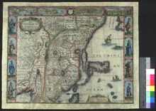
Africae, described, the manners of their habits, and buildings newly done into English
British India
États-Unis de l'Amérique septentrionale avec les Isles Royale, de Terre Neuve, de St Jean, l'Acadie
Fifth map, or, Map of 1733
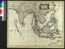
India quae Orientalis dicitur, et Insulae adiacentes
Indiae Orientalis, insularumque adiacientium typus
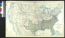
Map of the United States of America Showing the Boundaries of the Union and Confederate Geographical Divisions and Departments, June 30, 1863
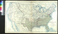
Map of the United States of America Showing the Boundaries of the Union and Confederate Geographical Divisions and Departments, June 30, 1861
New Map of Indostan or East Indies
Tabula Indiae Orientalis
The Kingdome of China
The United States of America confirmed by treaty, 1783