MU Logo
Digital Library University of Missouri
Search
Submit
Main navigation
About
Collections
Home
Maps
Displaying 1 - 5 of 5
Search
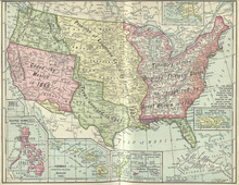
Colored map of Louisiana Purchase territory and all acquisitions
Map of the City of St. Louis, showing street car lines, location of World's Fair Grounds, and the store of B. Nugent & Bro. Dry Goods Co.
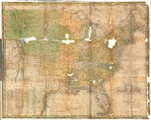
Map of the United States, constructed from the latest authorities, 1826
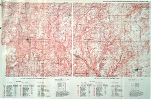
Soil map of Daviess County (northwest sheet) : soil map of Daviess County (northeast sheet)
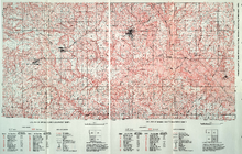
Soil map of Daviess County (southwest sheet) : soil map of Daviess County (southeast sheet)